Maps & Navigation

Yandex Go: Taxi Food Delivery
Yandex Go
Car and scooter rides, delivery of items and restaurant food.
• RIDES
Pick your service class
Ride Economy for everyday errands. Comfort and Comfort+ to relax with more legroom. Minivan for big groups, traveling with skis or bicycles, or trips to the airport. Carpool for discount rides with other users, and City to City for convenient rides between cities.
• CITY TO CITY
When you need a ride to a different city, choose City to City. No extra stops or transfers, and the comfort you're used to in a car is now way more affordable. Schedule your ride in advance and save even more.
• CARS WITH CHILD SAFETY SEATS
Select the With Kids section and request a ride with one or two child safety seats for different ages. Drivers in these service classes have passed an additional exam on traveling with children.
• YANDEX GO ULTIMA
For rides to business centers or meetings, choose the Business service class. Premier and Elite classes have flagship cars with the highest rated drivers, and Cruise offers business class cars for large groups.
Each driver is interviewed in person and tested on service requirements. Drivers are ready to open the door for you and listen to all your suggestions about the route, music, and car temperature.
• DELIVERY
Have a courier pick up your printer after repairs, hand over documents to a contractor, or haul off that old couch you sold. For large items, you can order a cargo truck. Couriers will arrive for pickup in just 15 minutes.
• SCOOTERS
Bright yellow Yandex Go scooters are already cruising around Moscow, Zelenograd, St. Petersburg, Krasnodar, Nizhny Novgorod, Yekaterinburg, Tula, Kaluga, Adler, and other cities. Rent up to three scooters from the same account, buy Minute Bundles to make rides more affordable, and use Yandex Plus to subscribe to Scooters for free unlocks.
• MARKET
Yandex Market has dozens of categories and millions of products for everyone. Search for items or select a category to find what you need. Add products to your cart, place an order, and track its status all in the Yandex Go app.
If you already added items to your cart in the Yandex Market app, you'll see your order in Yandex Go and can continue checkout. If items are out of stock, we'll offer similar products at approximately the same price.
Track your order status in the app.
• CARSHARING
Our fleet tops 16,000 vehicles with more than 18 models. Drive anywhere in or outside the city, or transport large items with Drive.
• MY CAR
Find gas stations, car washes, and charging stations for your car directly in the app.
• FOOD FROM RESTAURANTS
Order delivery from independent and popular chain restaurants. Stock up on snacks for a party, soup, khachapuri, wok, sushi, pizza, and vegan options.
Delivery from signature restaurants is handled by Yandex Eats Ultima.
•TRAVEL
In some cities, the app already has Yandex Travel: everything you need to make your next trip easier and more fun. Book hotels and buy airline, train, and even city-to-city bus tickets.
• TRANSPORT
View schedules for buses, trams, commuter trains, and other public transport, compare routes, and find the nearest stops and convenient transfers. Available in some cities for now.
• PLUS POINTS
Earn cashback points for rides in Comfort, Comfort+, and Ultima service classes, as well as for orders in Lavka, Yandex Eats, and Yandex Market. Use Plus points to save in various Yandex services.
Availability of services and options may vary depending on the region.

inDrive. Rides with fair fares
A great taxi alternative, inDrive (inDriver) is a rideshare app, where you can find a ride or which you can join to drive, as it is also a driver app.
But that’s not all! You can also use this app to travel to other cities, send and receive packages, book a truck for your personal or business needs, and even hire a local pro to help you with whatever you need. You can also sign up as a courier or tasker. A fair price is the one you agree on — not hope for. inDrive exists to prove that people can always come to an agreement.
Silicon Valley’s new success story, inDrive, formerly inDriver, is a free ride share app available in more than 888 cities in 48 countries. We are growing fast by putting the power back in the hands of people, be they customers, drivers, couriers, or other service providers.
As a customer, you can quickly find a ride or another service you need and agree on a fair fare with your driver or service provider.
As a driver, you can make more than any taxi driver with an ordinary drive app since you can drive flexibly on your schedule and choose which rides you take. The same goes for our couriers and service providers.
inDrive is not only a ride app or a drive app, it offers many more services based on the same model:
CITY
Affordable everyday rides with no surge pricing.
INTERCITY
A safe and convenient way to travel between cities.
COURIER
This door-to-door on-demand delivery service is a fast and safe way to send and receive packages of up to 20 kilos.
FREIGHT
Book a truck for freight delivery or your moving needs.
Why Choose inDrive
QUICK AND EASY
It's simple and fast to request an affordable ride — just enter points "A" and "B" in this ride share app, name your fare and choose your driver.
OFFER YOUR FARE
An alternative to your cab booking app, inDrive provides you with a tailored, surge-free rideshare experience. Here you, and not the algorithm, decide on the fare and choose the driver. We do not set the pricing according to time and mileage like a taxi booking app.
CHOOSE YOUR DRIVER
Unlike any known taxi booking app, inDrive lets you choose your driver from a list of the drivers who accepted your ride request. In our ride app, you can pick them based on their price offer, car model, arrival time, rating, and the number of completed trips. It is the freedom of choice that makes us a unique alternative to any cab app.
STAY SAFE
See the driver's name, car model, license plate number, and the number of completed trips before accepting the ride — something that is rarely to be found in an ordinary taxi app. During your trip, you can share your trip info with family or friends using the "Share Your Ride" button. We're continuously adding new safety features to our car booking app to make sure both riders and drivers can enjoy a 100% safe experience.
ADD EXTRA OPTIONS
With this alternative cab app, you can write your specific needs or any other details in the comments field like "traveling with my pet," “I have luggage," etc. The driver will be able to see it in their driving app before they accept your request.
JOIN AS A DRIVER & MAKE EXTRA MONEY
If you have a car, our driving app provides a great opportunity to make extra money. Unlike any other cab booking app, inDrive lets you see the rider's drop-off location and fare before you accept the ride request. If the rider's price doesn’t seem enough, this driver app allows you to offer your fare or skip the rides you don’t like with no penalties. The best thing about this car booking app is its low-to-no service rates, which means you can make more money driving with this great taxi app alternative!
Whether you are looking for a new driver app or need a ride, you can get a unique rideshare experience with this great taxi alternative. Install inDrive (inDriver) to ride & drive on your terms!

Bolt: Request a Ride
Make getting around easier with Bolt! Whether you need a ride across town, an airport transfer, or a scooter to zip through traffic, our app makes it easy to move around confidently and conveniently.
WHY CHOOSE BOLT?
- Request a ride in seconds: enjoy safe, affordable rides with top-rated drivers.
- Transparent pricing: see your fare upfront so there are no surprises.
- Multiple payment options: pay securely using a credit/debit card, Apple Pay, Google Pay, or cash.
EASY ORDERING:
- Open the app and set your destination.
- Choose from various ride types to suit your needs (Comfort, Premium, Electric, XL, and more).
- Track your driver in real time.
- Arrive in comfort and rate your experience.
SAFETY FIRST:
Some of Bolt’s safety features require the app to run in the background.
- Emergency assist button: discreetly alert our Safety Team in case of emergencies.
- Audio trip recording: record audio during rides for added peace of mind.
- Private phone details: your contact information stays confidential when you call a driver.
PLAN AHEAD:
Need an airport transfer or an early morning ride? You can schedule your trip in advance from 30 minutes to 90 days before your expected pickup time.
*JOIN BOLT PLUS TO UNLOCK PREMIUM FEATURES!
Get the best of Bolt with Bolt Plus. Enjoy exclusive perks that save you time and money, making every ride smoother and more convenient.
*BOLT DRIVE:
We're committed to our carbon net zero goal by 2040. That's why we're increasing the lineup of electric and hybrid cars in Bolt Drive, our car-sharing service. You can also rent Bolt scooters and e-bikes via the app.
*DELIVER PACKAGES
Use the 'Send' ride type to arrange fast and convenient parcel delivery in your city.
Bolt is available in 50 countries and 600+ cities worldwide (see the full list at https://bolt.eu/en/cities/). We rebranded from Taxify to Bolt in 2019.
Bolt is the perfect taxi alternative for fast, reliable, and affordable rides. The app provides a seamless ride-ordering experience whether you’re commuting, travelling, or running errands. So, the next time you need a ride, choose Bolt!
*Bolt options differ by location. Check the app for availability in your city.
Earn money driving with the Bolt Driver app. Sign up: https://bolt.eu/driver/
Questions? Get in touch via [email protected] or at https://bolt.eu
Follow us on social media for updates, discounts, and offers!
Facebook — https://www.facebook.com/Bolt/
Instagram — https://www.instagram.com/bolt
X — https://x.com/Boltapp
SmartTruckRoute 2 Nav & IFTA
The only truck nav app that does not collect or sell your personal data
=============================================================
Truck Routes Updated HourlyIf you need Tech Support feel free to TEXT or Call 7249011115 SmartTruckRoute is the only truck GPS system where maps and routes are updated hourly and supported by verified truck driver feedback from over 500,000 truck drivers. Unlike other apps for truck navigation we do not sell your data nor do we access your personal information. We are subscription-based. Our routes are created on our servers where thousands of routes are analyzed before we display the best one to you.
Our app is not free as we pay our engineers and cartographers. Free apps make money by tracking you, selling your private data, and pushing ads. Our team is based in the US and offers support by phone, email, and texting.
FREE 2-Day trials are automatic.
Takes only 3 minutes to install the complete system with maps!
For questions or help in processing your order, TEXT or call 724-901-1115
Includes alternative route
We also make smartbusroute and smartrvroute
This app helps commercial drivers navigate away from low bridges and areas where trucks are not permitted such as parkways and residential areas. The app will give you voice-guided turn-by-turn navigation. Maps and routing are updated daily.
SmartTruckRoute GPS Navigation is available for the following countries:
United States
Canada
Mexico
( Australia versions are available as separate apps)
What's New in Version 2?• App works in the background even when you are talking on the phone
• Easy, new interface makes it faster to use
• partnering with google and Waze
• State Odometer report is built-in (no add-on required)
• Voice recognition for an address finder
• IFTA mileage reports (included)
• HoS
• Fuel Prices
Why we are better...• Instant Truck Routes on your Android Smartphone or Tablet!
• Our app unlike other truck navigation apps does not spy on or track your personal information. See agreements of other apps.
• No lengthy downloads
• Daily map updates with Permanent and Temporary Truck Restrictions, and up-to-the-minute traffic.
• Truck friendly. Unlimited routing.
• Turn-by-turn voice instructions and warnings
• Hands-free operation. Speak your destination or give the command
• Driver feedback loop allows drivers to give real-world mapping and routing experience feedback.
• View satellite images at your destination.
• Configure the app to reflect the size and weight of your vehicle to ensure the best route. The default settings are set up for an 18 wheeler: 80,000 lbs, 53' length, 13'6" height, 8' 6" width. You can easily change these settings to be higher or lower to accommodate your vehicle size or Hazmat Level. Also supports motor coaches.
• Find Truck specific points of interest, truck stops, rest areas, repair facilities, weigh scales
• Driving assists: traffic and weather display, lane assist, speed limits, state border crossings, route export
• Odometer export with IFTA Fuel Tax Report Requirements
• Efficiently uses cellular data which results in very low data usage (1 gig/month, see Help section to learn how to use even less).
• via points
• Dispatch routes directly from your browser to your phone. Use www.smarttruckdispatch.com
• Talk while navigating
• Enhanced night mode
• Free Updates
• One-time payment, there are no recurring fees.
Free APIs for developers.
Refund Policy:
If you are not satisfied with the application you can request a refund within 48 hours of your download and specify the reason for the refund request. http://www.smarttruckroute.com/refund.php.
Want a Free Trial? Email: [email protected]
Company based in Boston, MA
Download SmartTruckRoute now for safe, reliable, truck GPS routing and navigation.

Ola: Book Cab, Auto, Bike Taxi
Upgrade your life the OLA Way!
Ever found yourself chasing Cabs, Auto Rickshaws or Bike Taxis? Craving your favorite food, or searching for a reliable parcel service? Welcome to your one-stop destination - the Ola App! With over 40 Million Trusted users across 200+ cities in India, OLA has become the Choice of the Nation.
🚗 Want to learn about our Services in OLA App?
Let’s start with the A, B & C of Rides:
🛺 A for Auto Rickshaw: Want Auto rides without the Fare drama ?
No more “meter nahi chal raha” excuses. Hop in for quick and affordable city trips with Transparent fares where your pocket will thank you.
Tuk Tuk Tuk Tuk 🛺 …… your OLA Auto is waiting for you.
🛵 B for Bike Taxi: Need to be as quick as a bullet?
Say hello to your little friend, Ola Bike Taxi! Slip through traffic jams like a pro ninja. Perfect for solo riders with places to be.
Why wait? Zip, zap, zoom!
🚗 C for Cab: Because You Deserve Options
Whatever your need, we’ve got an OLA cab for that:
🚗 OLA Mini: Quick, comfy & wallet-friendly.
🚘 OLA Prime Sedan: Spacious sedans, perfect for longer rides where you can Netflix & Ride in comfort.
🚙 OLA Prime Plus: A touch of luxury & Guaranteed no cancellations. Just you and your premium quality ride with Top notch drivers.
🚐 OLA Prime SUV: Traveling squad-style for a trip? Get Spacious SUVs with ample room for your Family or Friends and their luggage.
OLA Rental Cars:
Need a flexible ride for a few hours? 🕒 Renting a car with Ola gives you the freedom to hire a car on your terms. Whether it’s for running errands, meeting friends or family, or cruising the city, you can make as many stops as you want 🚗.
OLA Outstation Cabs:
Planning a long intercity ride? Pack your bags for a dream vacation or a hometown visit! 🌆 Sit back, vibe to your playlist 🎶 and let us handle the wheel 🛣️🚖.
But why Ride Ola?
🔒 Verified OTP:Travel OLA-round only after confirming with a secure OTP.
🧳 Luggage-Friendly: Plenty of space for all your essentials.
🕒 Schedule Rides: Plan your travel with ease & never miss your ride.
📞 SOS Feature: Prioritizing your safety every step of the way.
🚨 Emergency Contacts: Keep your loved ones in the loop.
Oh wait! It does not end here. We are more than just rides now.
🍔 Food Delivery:
Knock Knock, your meal is here! Ola Foods now delivers love on plate.
🍉 Choose from endless Desi & International cuisines to mouthwatering snacks or desserts. After all, a happy tummy = happy ❤️!
😋 Over 9000+ restaurants with a range of top choices & Nearby spots, including Domino’s, Pizza Hut, McDonald’s, Starbucks, Subway, Burger King, KFC & more.
💸 Order meals at pocket-friendly prices! With discounts up to 50%, make your expenses lighter & your tummy heavier.
🥗 Switch to our New Veg mod for Vegetarian lovers.
So what are you waiting for? Your Food’s just a tap away.
📦 Parcel Delivery:
Got something to send? Or waiting for that "urgent" delivery?🏃♀️ Zip packages across the city via OLA Parcel.
Send Packages: 📤Pack it & Send it. Enter the pickup & drop-off locations, we’ll handle the rest! 🚚
Receive Packages: 📥 Track it & Receive it. Keep an eye on the live tracking & get your package delivered right to you! 📦✨
Booking a Cab, Ordering Food, or Sending & Receiving a Parcel? OLA super easy all-in-one app will guide you every step of the way.
✅ Pick Your Location Easily. Yes, even that chai stall near the signal! 📍
✅ Pay Your Way – Cash, UPI, Cards and more!
✅ Track your ride in Real-Time 🚀
Special Offer
It’s raining GOLD here! 🌟 Earn & redeem OLA Coins for epic discounts on every rides, meals & courier services and save more 💰.
Just open the app and see how effortless it is! 😉 Download, tap and get the OLA-timate Experience! ✨

Moovit: Your Transit Tracker
Transform the way you navigate your city with Moovit, the all-in-one app for urban transit. Whether you’re taking the bus, subway, train, or even hopping on a dockless scooter, Moovit delivers essential information to streamline your journey.
Why Choose Moovit?
- Real-Time Arrivals: Access up-to-the-minute arrival information directly from GPS on buses and trains. No more guessing—plan your trips with confidence and avoid unnecessary waiting.
- Seamless Digital Payments: Effortlessly purchase and validate your bus and train tickets with just a tap (available in select cities), making your travel experience smoother than ever.
- Instant Alerts: Stay ahead of disruptions with real-time alerts about service changes, delays, and traffic issues. Moovit keeps you informed so you can adjust your plans on the fly.
- Step-by-Step Live Navigation: Navigate your route with live, guided directions from point A to B. Know how far to walk, get real-time arrival updates, and receive notifications as you near your destination.
- Augmented Reality Way Finder: Locate your bus or train stop easily with our innovative AR feature, ensuring you never miss your ride.
- Community-Powered Insights: Leverage user-reported issues to stay updated on station conditions, service disruptions, and schedules, ensuring you have the latest information at your fingertips.
- Personalized Favorites: Quickly access your favorite lines, stations, and places. Get real-time updates on any changes that may affect your regular routes.
- Comprehensive Bike Routes: Plan bike-friendly routes alongside your transit options. Access updated bike docking stations and integrate bike trips with public transport seamlessly.
- Offline Maps: Explore transit maps offline or underground, ensuring you always have the information you need, even without a signal.
Moovit proudly serves over 930 million users in more than 3,400 cities worldwide, collaborating with leading public transit agencies to provide you with the best urban mobility solutions.
You only need one app for all your transit needs, covering the U.S. and 112 other countries in 45 languages. Whether you want to know bus times, train schedules, or the last departures from any stop, Moovit has you covered.
Download Moovit today—ride with confidence!
Contact us:
* https://support.moovitapp.com/hc/en-us/requests/new?ticket_form_id=175869
* https://www.facebook.com/moovit
* https://twitter.com/moovit
Terms of Use
https://moovitapp.com/en-us/legal/terms-of-service-en

Rapido: Bike-Taxi, Auto & Cabs
Tired of the endless traffic and always running late? Say goodbye to your commute woes in just 5 minutes with Rapido (रैपिडो)—India’s first and largest Commute Service!
Whether you need to zip through traffic on a Bike-Taxi, hop into a comfortable auto, or relax in a cab, Rapido has got you covered. We’re here to help you save time, save money, and get to your destination quickly and comfortably, every single time.
With a presence in over 500 cities across India, a community of 75+ million satisfied customers, and having done a billion rides, Rapido has revolutionized how India travels. Our fleet of over 1 million Captains (Bike-Taxi, Auto and Cab) are ready to take you where you need to go, ensuring you reach your destination on time, even during the busiest hours. Rapido is a game changer for intra-city travel and first-mile, last-mile connectivity, offering you the most affordable rides in just 5 minutes.
Why Choose Rapido?
Imagine stepping out the door and getting a ride within 5 minutes – no more waiting in long queues or stuck in traffic jams. Whether you’re heading for work or a weekend outing, Rapido offers a variety of quick and affordable ride options:
Bike-Taxi: Beat the traffic and reach your destination faster. Perfect for solo travelers who need a quick, affordable ride.
Auto Rides: Ride comfortably and affordably with Rapido Auto! With our Flexi Fare option, you get to choose the price that fits your budget.
Cabs: If you’re traveling with family or friends, our cabs offer a relaxed ride at low prices.
Rapido isn’t just quick, it’s also wallet-friendly. We provide affordable rides with exciting offers to help you save even more. Whether it's a busy weekday or a casual weekend trip, you'll always find a quick, affordable, and reliable ride on Rapido. No more relying on expensive taxis or overcrowded buses. Whether you're commuting to or from the metro, ride hassle-free with Rapido's Auto or Bike-Taxi – quick, comfortable, and easy on your pocket!
Download the Rapido App now and Join the Rapido Revolution!
Get a ride in 5 minutes at unbeatable prices.
Your Safety, Our Priority!
At Rapido, your safety is non-negotiable. All our rides—Bike-Taxi, Auto, and Cab—are insured by Acko Insurance at no extra cost. Our captains are trained to follow all safety protocols, ensuring a secure ride. For Bike-Taxi passengers, we provide helmets for added protection. No matter the ride, Rapido ensures your safety and peace of mind.
Easy-to-Use App
Booking a Rapido Auto, Bike-Taxi, or Cab is now easier than ever! No more juggling OTPs. Just use your unique PIN for every ride and enjoy a seamless, hassle-free experience.
Rapido additionally offers services such as Bike Lite, Bike Metro, Parcel, Auto share, Auto Pet, and Auto Parcel under one umbrella.
Rapido introduced Metro ticket booking through the app to cater to the millions who commute through the metro everyday. Moreover, Rapido improved the first-mile, last-mile connectivity by launching Bike Metro to & from Delhi Metro, Chennai metro, Hyderabad metro & Kochi Metro.
Favourites – Save frequently visited locations for easier access.
Live tracking – Follow the real-time location of the ride.
Rapido App is available on both Android and iOS platforms.
Got more queries? Get them all answered! Follow us on our social media platforms and stay updated.
Facebook: https://www.facebook.com/rapido4bike/
Instagram: https://www.instagram.com/rapidoapp/
Twitter: https://twitter.com/rapidobikeapp
LinkedIn: https://in.linkedin.com/company/rapido-bike
YouTube: https://www.youtube.com/channel/UCDrFiyq8m0rLr8SgXiXLqgw
GPS, Maps, Driving Directions
Discover the ultimate Navigation app for all your travel needs! Whether you're driving, walking, or cycling, our app offers accurate navigation, real-time traffic data, and turn-by-turn directions to help you reach your destination quickly and efficiently.
Key Features:
Maps & GPS Navigation: Access highly detailed maps and utilize precise GPS Navigation for seamless travel experiences, both on and off-road.
Offline Maps: Download offline maps for uninterrupted navigation even when you're without a data connection. Enjoy offline directions with our powerful GPS route finder feature.
Real-Time Traffic Updates: Stay ahead of the curve with real-time traffic data, enabling you to avoid congestion and find the fastest route. Get instant updates on road conditions, traffic jams, accidents, and weather alerts.
Driving Directions: Whether you need voice navigation or turn-by-turn navigation, our app delivers accurate and intuitive driving directions for a hassle-free journey.
Route Planner: Plan your trip with our easy-to-use route planner, ensuring you take the most efficient and scenic route available.
Location Sharing: Share your current location with friends and family for better coordination, whether you're meeting up or keeping them updated on your travel progress.
Compass & GPS Route Finder: Built-in Compass and GPS route finder tools help you stay on track, no matter where your adventure takes you.
Voice Navigation & Voice Directions: Our advanced voice guidance system ensures you never miss a turn. Choose voice navigation for hands-free assistance during your drive or voice directions to guide you through every twist and turn.
Offline Navigation: Perfect for long trips in areas with spotty internet coverage, our offline navigation ensures you always have access to reliable directions.
Turn-by-Turn Navigation: App uses foreground service to provide continuous and reliable navigation , providing turn-by-turn directions, real-time traffic updates, and offline maps.
Weather Alerts: Stay informed about current and forecasted weather conditions that may affect your travel route.
From location sharing to voice guidance, route planning, and offline maps, every tool is designed to give you a seamless and stress-free travel experience.
Why Choose Us?
Accurate Navigation: Rely on precise and real-time GPS data for fast, reliable routes.
Comprehensive Directions: Whether you need driving directions, walking paths, or the best cycling routes, our app has you covered. Best and free maps app for cycling directions and walking directions, trail maps, road trips. It's a free navigation app.
Customizable Routes: Customize your routes with our route planner to match your travel preferences, be it the fastest way, scenic paths, or avoiding tolls. Multi-stop navigation with the route optimization feature (circuit route planner). Routes for Driving/Cycling/Walking/Shortest Distance. Automatic rerouting gets you back along your way, even offline, trail maps.
Perfect for daily commuting, all trails, road trips, transit or exploring new places, our app ensures you never lose your way. Download now free offline gps navigation app for accurate GPS directions, and location tracking. It's a free gps navigation app with voice directions and best maps app for android and free offline gps navigation app and GPS Tracker app.
We know the importance of your location data. Our app only accesses location information when providing navigation guidance. You'll always be notified when the foreground service is running.
Follow Us On:
https://twitter.com/AppstudiosGps
https://www.facebook.com/gps.appstudios/
https://in.pinterest.com/gpsappstudios/
https://www.instagram.com/gpsmaps.appstudios/
Sygic GPS Navigation & Maps
Sygic GPS Navigation & Maps is innovative GPS navigation app with monthly-updated offline maps and with precise live traffic & speed camera alerts, both updated in real time. It‘s trusted by more than 200 million drivers worldwide. Offline 3D maps are stored on your phone for GPS navigation without an internet connection. We update the maps multiple times per year for free, so that you can always rely on Sygic GPS Navigation.
NAVIGATE ANYWHERE, EVEN WITHOUT AN INTERNET CONNECTION
• 3D Offline maps of all countries in the world, from TomTom and other providers
• Free map updates multiple times per year
• Voice-guided GPS navigation with precise directions and spoken street names
• Millions of interesting Places (POI)
• Pedestrian GPS navigation with walking directions and tourist attractions (POI)
• Satellite Maps - search for your target address, point of interest or favorites in the satellite view.*
• Customize your navigation arrow. Try everyday car, van or even formula.
ESCAPE THE TRAFFIC
• Avoid traffic jams with the most accurate real time traffic information with data collected from more than 200 million users worldwide*
ANDROID AUTO CONNECTIVITY
• Just connect your phone to your car's screen and stay focused on the road
• You can use your car's touchscreen, knobs, or buttons to control the app
STAY SAFE
• Advanced safety features make driving in unfamiliar territories easier
• Speed limit warnings show you the current speed limit and the upcoming speed limit changes
• Dynamic Lane Assistant guides you into the correct lane
• Head-up Display (HUD) projects navigation onto the windshield of your car, making driving at night safer
• Sign recognition detects speed limits from traffic signs as you drive
• Dashcam records the road ahead and automatically saves video in case of an accident
• Real View Navigation is an augmented reality feature for even better and safer driving experience
• Cockpit shows you the real time performance of your car.
• Real time route sharing lets you share your estimated time of arrival & current position on a map*
• Wrong-way warning (in partnership with Bosch)**. If you are driving in the wrong way or someone is driving in the opposite direction, we will warn you.*
SAVE MONEY ALONG YOUR ROUTE
• Park easily with parking place suggestions and live info about prices and availability*
• Set your fuel type and fill up for the best price with live information about fuel prices*
• Avoid speeding tickets with Speed camera warnings*
• Save money on roaming charges with offline maps
Do you want to find out how it feels to have Premium+? Try our 7-day trial for free and discover all Premium+ features. After that, you can decide if you want to prolong your subscription or use basic features only.
Should you have any questions, please visit sygic.com/support. We are here for you 7 days a week.
If you like our app, please leave a review or spread the word at sygic.com/love. Thank you for your support.
*Please note that this feature requires an internet connection.
Note: Sharing videos from Dashcam is forbidden by law in these countries: Austria, Belgium, Luxembourg, Switzerland, Slovakia, Spain.
Note 2: Dashcam, Traffic Sign Recognition, and Real View are part of the new feature SmartCam. SmartCam merge all camera features into one. The SmartCam is a part of our Premium+ subscription.
**Wrong-way driver feature is available in Sygic GPS Navigation for Android, version 22.2. or higher.
More information about features can be find in glossary: https://www.sygic.com/what-is
By installing, copying, or using all or any portion of this software you accept all the terms and conditions of this agreement: https://www.sygic.com/company/eula

Radarbot Speed Camera Detector
The only app that combines real-time alerts with the best offline radar detection alert system. With Radarbot, you will have the best radar alerts, real time traffic alerts and specific speed limit alerts for different vehicles (cars, motorbikes, trucks and commercial vehicles) in one powerful app. Drive while focusing on what really matters and enjoy your trip.
With Radarbot, drive more peacefully. Safer. Better.
RADAR WARNINGS
Enjoy driving without having to worry about jeopardizing your driver’s license or your safety. Avoid traffic fines and penalties by receiving clear warnings before reaching a radar:
- Fixed radars.
- Speed trap hotspots.
- Tunnel radars.
- Average speed cameras (the app shows your average speed).
- Traffic light cameras.
Plus:
- Dangerous driving areas.
- Seat belt or cell phone use cameras.
- Restricted area access control cameras.
- Potholes and speed bumps on the road.
* FEATURES:
- It works in any country.
- It is compatible with other apps. You can use Radarbot simultaneously with other GPS navigators or your favorite music app. You will continue to receive alerts in the background or while the screen is turned off.
- Alerts only in the direction you are driving. The app automatically ignores radars in the opposite direction or off route.
- Voice alerts.
- Sound alerts when approaching a radar or going over the speed limit.
- Vibration mode for motorists.
- Completely configurable warning distances and parameters.
- Automatic Bluetooth connection and startup.
- Compatible with Wear OS.
REAL-TIME ALERTS
Real-time alerts will warn you of any unexpected circumstances. Radarbot has a community of over 50 million drivers worldwide to share and receive alerts. Find out immediately what is happening on the road and avoid traffic jams, road hazards, accidents, mobile radars, police, helicopters, drones and much more.
UPDATED RADARS
Radarbot has the most powerful and updated radar database in the world. Our team of experts performs daily updates to ensure that the database is always up-to-date. Not a single radar can escape the prying eyes of Radarbot!
RADARBOT WORLDWIDE
Try our "FREE" version totally free of charge and with no time limits. If you want to enjoy the full experience, you can try "Radarbot GOLD" or "Radarbot GOLD RoadPro" with integrated GPS navigation, unique advantages and, of course, no advertising.
GPS NAVIGATION AND SPEED LIMITS
Discover the power of Radarbot. The GOLD version provides you everything you need while on the road in a single app: GPS navigation, radars and speed limits. You will reach your destination safely, even if you don't have an Internet connection. Travel and receive radar alerts all over the world, without worrying about mobile network coverage.
Where would you like to go?
* FEATURES:
- Offline navigation and 3D maps.
- Option to choose a route with fewer radars.
- Road speed limits.
- Alert for school areas and their radars.
- Radarbot copilot. Put your seat belt on!
ARE YOU A PROFESSIONAL DRIVER?
"Radarbot GOLD RoadPro" includes everything a professional driver could need:
- Routes with special restrictions for trucks and commercial vehicles.
- Speed limits and specific radars for trucks.
- Distance alerts adapted to heavy vehicles.
If you have any doubts or questions, we would be more than happy to assist you at [email protected] or from the customer support option within the app.
Download Radarbot now and become a member of the "Enjoy driving!" movement.

CarInfo - RTO Vehicle Info App
CarInfo is an all-in-one app for all your vehicle info needs and RTO vehicle information app. You can Check Challan or Echallan, Sell car, Buy Insurance, Buy a new car, parivahan or mparivahan sewa and many more. Manage all your vehicles effortlessly in one place with the CarInfo app.
✔ Vehicle Owner details
✔ Check Challans and Pay Online
✔ Buy and Renew Car/Bike Insurance
✔ Check Pollution Expiry date & set Reminders
✔ Recharge fastag app
✔ Service History Check for your vehicle
✔ Personal Garage
✔ Parivahan sewa
✔ Buy & sell your vehicle
✔ Buy new and second hand car
✔ Buy car accessories
✔ Number plate checker
✔ RTO Details
✔ Check resale value
⇒ Insurance: Check & verify expiry of car insurance, bike insurance, motorcycle insurance, scooter insurance and 3rd party insurance set reminders to not miss and renew insurance with zero commission with trusted partners like Acko, Insurance dekho and more.
⇒ Echallan: Streamlined traffic fine management. Check pending echallans on your car/bike and also get them resolved online using the car info app. Check for LokAdalat which aims to provide a simplified and efficient mechanism for challan resolution.
⇒ FASTag Recharge - Buy FASTag, recharge FasTag issued by 10+ banks:
IDFC FasTag
SBI FasTag
IDBI FasTag
⇒ Sell Car: Sell your car effortlessly online. Don't miss out on the best price! Enjoy instant payments, hassle-free paperwork at your doorstep.Explore top quotes from trusted partners like Spinny & Cars24 for the best deals.
⇒ Service History: Get complete Service Records for a vehicle In One Click. Verify important details like Odometer reading, Accident History & parts replaced.
⇒ Personal garage: Personalized virtual garage helps keeping track of all your cars and bikes in one easy place.
⇒ Car Accessories: Buy car seat covers to mobile holders at Unbeatable prices!
→ Personal Loans
Apply for Personal Loans on our platform
Early salary Services Private Limited [https://earlysalary.in/lending-service-provider/]
Example of How Personal Loan works:
Loan Amount - 150,000
ROI - 18%
Processing Fee - 3%C
APR - 21%
APR ranges between 15% - 40% (min - max), depends customer profile
EMI - 9571
Repayment ranges b/w 3 - 60 months (min - max)
Total Payable - 9571 x 18 months = 172,276
Total Interest Payable = 172,276 - 150,000 = 22,276
*Note: These numbers are for representation purposes only. Final APR will depend on the customer's credit assessment.
*APR (Annual Percentage Rate) is the total cost of borrowing, including interest and fees, giving a clear picture of the loan's true cost.
Other Features:
CarInfo is the best app to manage all your car records and app has made easier to manage all related features related to car management such as:
Owner Details
Renew insurance
RC check
Service history check of the car
Sell car
Buy second hand cars at doorstep partnered with Spinny and CarDekho
Number Plate Checker
Car Accessories such as car perfume, seat covers, alloy wheels and etc.
Pay challan and check echallan
Parivahan and mparivahan
RTO Vehicle information
Know your vehicle details | Get vahan information | mParivahan owner details | Parivahan/m parivahan vehicle details | vahan registration details | Buy and Sell car and check challans. Accessing vehicle owner information is crucial for various situations such as road accidents, purchasing second-hand vehicles, and in cases of lost documents or theft. Our portal provides RTO vehicle details online, including car and bike registration details, Vahan owner information, and RTO information for any state in India, like Maharashtra, Delhi, Karnataka, Rajasthan, Gujarat, and more.
Disclaimer: We are not related to any RTO authority of India. All details shown in the app about vehicle owners are publicly available on the Parivahan/mparivahanwebsite. We are only acting as an intermediary platform to make this information available

Yango: taxi, food, delivery
Yango is an easy-to-use app for getting around the city
Fill your life with movement with the Yango app. It puts the whole city in your hands and lets you ride wherever you want to go. Do it all by making an order via the Yango app.
An international service
Yango is a ride-hailing service that operates mobility and delivery aggregators in 19 countries, including Ghana, Cote d'Ivoire, Cameroon, Senegal and Zambia.
Choose the right service class for you
Reach your destination at the right level of comfort and price for you. Choose from several service classes. Start is perfect for short rides. Economy is awesome for when you need a car fast. Comfort lets you sit back and enjoy the ride. And The Fastest offers rides when the service class doesn’t matter… you need the closest available taxi!
Ride safely
Safety is our top priority. You’ll see who’s coming to pick you up and in which car right in the app. You’ll see the driver’s name and rating and be able to share your ride with whomever you like so they know where you are.
Smart destinations
Yango will suggest destinations for your taxi ride based on your ride history, like first offering ‘home’ as a destination because it’s your most common taxi order on weekday evenings. Ride taxis the smart way!
Multiple destinations, one route
The Yango taxi app makes everyday life easier. Like picking the kids up from school, dropping a friend off at a market, and doing some quick shopping on the way. Just add a new taxi order stop in the app, and Yango will recalculate a new route for the driver. That makes it even easier to ride a taxi.
Order for someone else
Yango lets you order friends and loved ones a ride by taxi. Get your mother to a doctor’s appointment with a taxi order. Send a taxi online to pick up your special someone. Or get each of your friends a ride home after a night out. You can order up to 3 cars at once.
Tell your friends about the Yango taxi app and get discounts
You can get discounts for your rides by inviting friends to use the Yango taxi app. Share your personal promo code with them and receive bonuses when they take their first ride. Ride taxi, tell friends, save. It’s as easy as that.
Enjoy your ride!
If you would like to share your feedback on the Yango taxi app or a specific taxi company, please use the feedback form located at https://yango.com/en_int/support/
Yango is an informational service and not a transportation or taxi services provider. See details at https://yango.com/en_int/

Trainline: Train travel Europe
Welcome, future Trainliner. Get on board with millions of world-wide users, today, to travel confidently with us – Europe’s leading train and bus app.
Why?
Whether heading to an international city or from an international terminal, in a matter of clicks you’ll be booking the best seats in advance or saving money on-the-day with our Best Price Guarantee. And for those who like to stay looped, you can turn on real-time notifications and keep an eye on live timetable tracking – you can even use Crowd Alerts to find out how busy your train is. Plus, forgetting, misplacing, or totally destroying your paper tickets becomes a thing of the past when you purchase digital versions through our app!
With so much to see and do, getting there should be the easy part – and when you book through our app, it is! Find cheap tickets for Eurostar, Avanti West Coast, GWR, LNER, National Express, Renfe, Iryo, Trenitalia, Italo, and many other European rail lines. Or if you want to buy bus tickets, simply search and book directly in the app. Need some travel inspo first? We got that covered, too, with travel blogs and suggested “popular journeys”.
So, whether you want to book bus seats, get cheap train tickets, or stay updated during your journey, you can always rely on our app to deliver the goods.
Why use Trainline to book train and bus tickets?
- Buy all your tickets in one place – plan your dream country-hopping journey on our app.
- Compare train and bus options from 260 train and bus companies.
- Compare prices and get cheap tickets in your preferred currency (USD, GBP, EUR, AUD, CAD, CHF, and SEK).
- Buy tickets with Amex, Google Pay, PayPal, and all major credit cards and debit cards.
- Add loyalty and discount cards to get benefits on cheap tickets on UK rail services, Eurostar, SNCF, Thalys, and Renfe.
- Book tickets in advance or buy same-day train tickets up to 15 minutes before departure.
- Buy tickets on your phone to skip station queues for selected routes.
- Add Cancel for Any Reason to your booking for cover up to 15 minutes before departure.
- Save plans for later and lock in tickets for up to 7 days.
- Find the best value train tickets using our price calendar.
Our partners:
Across Europe and the UK, you can browse routes with
Eurostar (UK, France and the Netherlands)
Heathrow Express (UK)
Avanti West Coast (UK)
GWR (UK)
National Express (UK)
London Overground (UK)
SNCF (France)
TGV Lyria (France)
Thalys (France)
Trenitalia (Italy)
Italo (Italy)
Renfe (Spain)
Alsa (Spain)
Deutsche Bahn (Germany)
ÖBB (Austria)
SBB (Switzerland)
NS (the Netherlands)
SNCB (Belgium)
Flixbus and many, many more…
No matter who you choose to rail with, we make buying European tickets a smooth experience while bringing you the best fares available for every fuss-free journey. But should you need it, our dedicated customer support team is on-hand (and on the phone) to help you navigate the railways of Europe. Just give us a call!
So, download our FREE Trainline app and get access to everything you need to train across the UK and Europe like a pro.
Visit our FAQs page to find out more: https://www.thetrainline.com/en/help/
Or, follow us on social:
FB: thetrainlinecom
TW: /thetrainline
IG: @trainline
*Average saving based on bookings made by Trainline US customers at least 30 days in advance vs within 7 days of departure, between 1.1.24 and 09.30.24 to travel between 05.01.24 and 09.30.24 and calculated on the 3 most booked EU routes. Adult fares only, single journey in standard class, based on price paid per passenger without Railcard.

GPS Speedometer - Odometer App
GPS Speedometer & Odometer 🚗🚆
Take control of your speed and distance tracking with GPS Speedometer—the ultimate GPS speed test app for drivers, bikers, and train travelers. Track your journey in real-time, whether you're commuting, on a road trip, or exploring by bike, and ensure a safer, smarter travel experience.
Why Choose GPS Speedometer? 🌍
🚀 Real-Time Speed Tracker: Accurately measure your speed with instant updates, whether you're driving, cycling, or on a train. Track your speed in real-time for safer journeys.
📏 Accurate Speed Odometer: Measure every mile with a reliable speed odometer and mile tracker for detailed trip analysis.
⚠️ Speed Limit Alerts: Set a speed limit, and get notified with vibrations, voice alerts, or alarms if you exceed it. Monitor your GPS speed test and stay within safe limits.
🌐 Universal Compatibility: Perfect for cars, motorcycles, bicycles, and trains, with seamless GPS navigation for all your journeys.
🔋 Battery Efficiency: Optimized for minimal battery usage, even during extended trips, keeping your GPS and distance tracker working smoothly.
🛤️ Route History & Insights: Access past trips, track your mileage, and visualize routes on the map with optional tracking.
Features that Elevate Your Journey: 🚗🚆✨
🎨 Customizable Dashboard: Choose from multiple themes and layouts to suit your style.
📍 Digital & Analog Modes: View your speed limit and distance in digital or analog formats, just like a real car speedometer.
🕒 HUD Display Mode: Project your speed onto your windshield for safer, distraction-free driving.
📉 Speed Tracker Statistics: Monitor real-time, average, and maximum speed, as well as detailed travel time and mileage.
🌍 Offline Mode: Continue speed tracker and distance without an internet connection, ideal for remote areas or train rides.
🔄 Flexible Speed Units: Switch between kilometers per hour (km/h), miles per hour (mph tracker), and knots.
📱 Widgets & Mini Display: Use the app as a floating window or widget over other apps for seamless multitasking.
📅 Detailed Travel History: Keep a record of all your trips with starting and ending points, total mileage, and more.
🧩 Multi-Orientation Support: Use the app in portrait or landscape mode, tailored to your preferences.
🛡️ Intuitive Safety Features: Alerts help ensure safe driving, while the battery-friendly design supports long journeys.
Speed Odometer Perfect for: 🎯
🚗 Car Drivers: Speed test kilometers per hour (km/h), miles per hour (mph tracker) car speedometer, mileage, and routes during commutes and road trips.
🚆 Train Passengers: Speed tracker, distance, and locations in real-time.
🏍️ Cyclists & Motorcyclists: Track speed limit, routes, and performance on two wheels, cycle and bike speedometer.
🚶♂️ Walkers & Runners: Measure pace, distance, and time for workouts or casual strolls.
🚢 Sailors & Flyers: Measure velocity across various modes of travel, including sailing and flying.
Start Your Journey with GPS Speedometer App 🚀
Download the best free GPS Speedometer & Odometer app today to measure speed, record distance, and track your routes on the go. Whether you’re testing speed while driving, cycling, or running, or just need a backup for your car speedometer, this GPS speed test app has you covered like digital speedometer. Stay informed, travel smarter, and track every mile—be it by car, bike, train, or on foot. 🌟📲

Yandex Metro
Plan your metro trip and know how long your journey will take, including any line transfers. The app displays the optimal route, shows which metro car will be most convenient, shows station exits on the map and forewarns of any closures.
• Metro map with everything you need to know
On the map you can see which stations are closed for repairs, and which stations are best for getting to railway stations and airports. Enlarge the map to see more detail, like different types of interchanges between stations.
• Optimal routes and metro cars for convenient transfers
Yandex Metro shows you how long a journey will take, the number of transfers and whether any stations are closed for renovations. It shows which metro car to choose to speed up your trip and not waste time when changing lines.
Information about metro exits
• Information about metro exits
See detailed information about every station: how many exits and which streets they lead to, working hours and warnings of any closures. Hail a taxi to pick you up from your chosen metro exit right within the app.
• Pay your fare in the app
Use the app to top up Moscow’s Troika and Strelka public transport cards.
• Accessibility
The app supports TalkBack, so it can be used by people with visual impairments.
• More than 30 schemes
– Russia: Volgograd, Yekaterinburg, Kazan, Moscow, Nizhny Novgorod, Novosibirsk, Samara, St. Petersburg.
- Austria: Vienna.
- Azerbaijan: Baku.
- Armenia: Yerevan.
- Belarus: Minsk.
- Hungary: Budapest.
- Greece: Athens.
- Georgia: Tbilisi.
- Italy: Milan, Rome.
- Kazakhstan: Almaty.
- UAE: Dubai.
- Poland: Warsaw.
- Portugal: Lisbon.
- USA: San Francisco.
- Turkey: Istanbul.
- Uzbekistan: Tashkent.
- Ukraine: Dnipro, Kiev, Kharkiv.
- Finland: Helsinki.
- Czech Republic: Prague.

Lalamove - Fast & Affordable
Lalamove – 24/7 On-Demand Delivery App
Need something delivered fast? Lalamove delivery app instantly connects you with a vast network of driver partners for fast, simple, and affordable deliveries anytime, anywhere. Founded in Hong Kong in 2013, we now serve 14 markets across Asia, Latin America, and EMEA, empowering businesses and individuals with hassle-free logistics.
Fast and 24/7 Delivery Service
Get matched with a driver fast, any time of day or night. From urgent deliveries to scheduled business shipments, we're here 24/7 with on-demand, same-day, next-day, and scheduled options. Need multiple stops? We're here for your delivery needs. For added convenience, we also offer add-on services such as helper assistance and the ability to arrange multiple stops for your delivery needs.
Wide Range of Vehicle Options for Every Need
From small parcels to large loads, we have the right vehicle for your delivery:
- Trucks: For furniture moves and bulk shipments
- Vans: For business logistics and mid-size loads
- Motorcycles: For quick, small-item deliveries
Efficient and Affordable Services
Get affordable delivery services with Lalamove's budget-friendly rates. Know your exact fee at Lalamove Delivery App before booking – move it with no hidden charges, no surprises. Our competitive pricing system helps you plan deliveries and trips while keeping costs low. Pay directly through the app or make a cash payment to your driver.
Professional and Reliable Drivers
Make your deliveries with our experienced and trained drivers. Lalamove ensures your packages are always secure. Move it with Lalamove.
Real-Time Tracking
Track your shipment's location and estimated arrival time in real-time through the Lalamove Delivery App from the moment it departs. Facilitate your planning by controlling the delivery process.
Earn Rewards While You Deliver
Every delivery earns you LalaPoints, which can be redeemed for exclusive rewards and discounts, making each transaction more rewarding.
Delivery for Anything, Big or Small
From urgent documents and small parcels to large furniture and construction materials, we handle it all:
- Small packages and urgent documents
- Furniture, second-hand items, and office relocations
- Wholesale products and commercial transportation
- Construction materials and large loads
- Grocery items, food, flowers, and gifts
- And much more!
NEW: Rides for Every Need & Budget in Indonesia, Malaysia, Philippines, Thailand, Vietnam!
Lalamove is now offering ride-hailing services, providing an affordable and pleasant transportation experience. Whether you need a ride for your daily commute to school or work, or a convenient transfer to the airport, Lalamove offers the flexibility to book instantly or schedule in advance at affordable rates. Enjoy the added assurance of real-time tracking, allowing you to monitor your ride and travel with peace of mind. Just Lalamove It.
How It Works: Simple & Fast Booking:
1. Open the App: Select ""Delivery"" or ""Ride"".
2. Set Locations: Enter your pick-up and drop-off points.
3. Choose Vehicle: Select the vehicle type that suits your needs.
4. Select Payment: Choose your preferred payment method.
5. Match & Track: Get matched with a driver and follow your delivery or ride in real-time.
Download the Lalamove app today and experience fast and affordable delivery and ride services!
Radar GO-X: HUD, GPS, Maps
Save your money by tracking speed cameras and police radar locations. Turn your smartphone into the perfect speed camera, radar alert system, map, and location tracker!
Features of Radar GO-X: HUD, GPS, Maps, Navigation:
⭐ Free Speed Camera Detector
⭐ Location tracker, family locator, and GPS tracker
⭐ Flight inquiries
⭐ Find nearby airports
⭐ See timetable schedules for airports
⭐ Calculate the routes for aircraft
⭐ Discover the distance between airports
⭐ Radar maps, GPS, and real-time map
⭐ Police Radar Detector that marks the location of speed cameras and police on the map
⭐ Voice radar, directions, and offline map
⭐ Real-time radar alert with sound notifications
⭐ Live radar, 3D Maps & GPS
⭐ HUD displays info on the windshield by reflecting the light of your phone
⭐ Real-time traffic alerts and speed camera detection system using GPS
⭐ Displays the distance to the nearest speed camera, its location, direction, and speed limit
⭐ HUD: You can use this app for the heads-up display while driving your car
⭐ See current speed, speed limit, and nearest radar points, ways at the same time
⭐ Use km/h or mile
⭐ Shows the current outside temperature, humidity, weather, and pressure depending on your location
⭐ Accurate weather forecasts
⭐ Thousands of local AM and FM radio stations live near you
⭐ Radio channels: music, news, sports, podcast, talk, comedy, etc
⭐ Internet radio stations broadcasting from 197 countries
⭐ Save your favorite radios. Easy to listen to the live radio broadcast ⭐You can find your way and Kaaba direction with our compass
⭐You can turn your face to the Kaaba with the help of our Qibla compass
Radar and Police detector
📡 Detect any speed radar gun with this cop radar. The speed limit app offers you a radar detector that can find any police radar. The police detector will save you the fines money!
📡 If you don’t have the budget for a new radar detector, we have a cheaper alternative: the radar detector app that is "Radar GO-X: HUD, GPS, Maps, Navigation"
📡 Radar detector app provides a credible source of info for real-time speed cameras on the live traffic road. It’s the most excellent radar detector and maps app. Navigation live traffic cops radar app for any speed cameras and go maps
Flight Tracker
Radar GO-X app helps you to find the current location of flights. You can see wherever they are. Besides that, you will get detailed information about flights.
Moreover, you will see the nearest airports from your location. Also, you can see their timetable's from our app. With that, you can discover the distance between airports. As with all that, you can calculate routes for the airports.
Head-up Display: HUD
Radar GO-X: HUD, GPS, Maps, and Navigation app includes a Head-up display feature that projects speedometer information directly onto your car's windshield, allowing you to keep your eyes on the road. You will get the distance of the next radar point, current speed, speed limits, and even speed camera warnings.
How to Use:
1. Open the app and click the "Head-up Display" menu.
2. Put the phone in front of your car windshield in a horizontal position
3. Driving information (current speed, speed limit, and next radar point) will be mirrored on the windshield from the smartphone screen.
4. Keep your eyes on the road and enjoy! :)
Location Finder & GPS Tracker & Family Locator
Share your location with your family using your android device. You can track where your family is after getting their permission. When loved ones leave home, use the family finder app to find out if they arrived safely and on time.
No longer needs to send those annoying "Where are you?" texts. You can find the location of your loved ones by using the location tracker and family locator.
< NOTE >: You can view the location of each family member's "ONLY" when they give permission. It requires consent!
We wish you a good and safe journey with Radar GO-X: HUD, GPS, Maps, Navigation App
TomTom GO Navigation
Join +10 million drivers and enjoy the most reliable sat nav app for both car and truck: TomTom GO Navigation Regularly updated maps stored on your phone for GPS navigation without an internet connection, with real-time Live Traffic and Speed Camera Alerts. Install now using the FREE TRIAL offer 😎
TOMTOM GO NAVIGATION: ESCAPE TRAFFIC, SAVE TIME & SAVE MONEY 🖤
✨ Steer clear of traffic and blocked roads in REAL-TIME
👮️ Drive hassle-free with SPEED ALERTS and warnings for fixed and mobile speed cameras
📱 Compatible with ANDROID AUTO – Get directions and real-time info on a bigger screen and in surround sound
⛽ Find the cheapest fuel along your route with live information about FUEL PRICES
📵 NO ADS, no distractions, and data PRIVACY at its best. See only what is important on the road
⤴️ Know exactly which lane to take with LANE GUIDANCE, never miss a turn with easy turn-by-turn directions
🅿️ TomTom ROUTEBAR always shows you all relevant warnings and notifications along your route
🚙 Smarter journeys for both cars and trucks, enter your vehicle's dimensions to get personalised guidance
🔋 Save your mobile data and battery using OFFLINE MAPS, while driving with up-to-date GPS navigation
🚛 Driving a TRUCK? This app offers you all you need:
• Find gas stations to fill up your specific fuel type
• Enter your dangerous cargo information to avoid certain roads
• Easily find truck rest-stops
• Define your desired maximum speed and get an adjusted ETA
Try our 7-day trial for free and discover all our premium features.
· The use of this app is governed by the Terms and Conditions at tomtom.com/en_us/legal/.
· Additional laws, regulations, and local restrictions may apply. You use this app at your own risk.
* The Speed Camera Services must only be used in accordance with laws and regulations of the country where you are driving. This functionality is specifically prohibited in some jurisdictions. It is your responsibility to comply with such laws before activating the services. You can enable and disable Speed Camera warnings on TomTom GO Navigation. Learn more at: tomtom.com/en_eu/navigation/mobile-apps/go-navigation-app/disclaimer/
** Offer limited to one free trial period per user.

Citymapper
Instantly compare your travel options in real-time across all transport modes!
Easily navigate your city with turn-by-turn directions for all your public transportation, walking, cycling and scooter trips.
Find the best route
► Simple city navigation and trip planning combining bus 🚎 subway 🚇 train 🚄 ferry ⛴ cabs 🚕 ride share 🚖 car share 🚗 bike share 🚲 e-scooters 🛴 and walking 🚶♂️Discover routes you never knew existed 🕵️♀️!
Hit the GO button for step-by-step directions
► Turn-by-turn navigation for your transit, walking, cycling and scooter trips. Choose between 3 different map views, see the charge levels of e-scooters and e-bikes around you, and avoid no-parking zones. We take care of the logistical thinking with our smart route planner so you are free to enjoy the ride 🙌
Experience one-stop-shop mobility
► Compare cab fares, hail a ride, hop on a shared bike or get on the nearest scooter. Our partners include: Uber, Lyft, JUMP, Lime, Bird, Spin, Skip, Scoot, Citi Bike, JerseryBike, Bluebikes, Indego, CaBi, Divvy, Metro Bike, Breeze, Bay Wheels, Healthy Ride, Relay, BCycle, SA Bike Share, GREENbike, Grid, RTC Bike, BIKETOWN, Biki 🚖 🚲 🛴
Beat the rush-hour crowd
► Live wait times and ETA so you'll never miss a bus, train or ferry again. Follow your public transportation as it’s approaching on a real-time map with our train & bus tracker. See the best train car to board, check the next train or bus stop, get alerted when it's time to get off, and get in and out from the best exit at any subway / train station ⏰
Smarten up your daily transit navigation
► Get daily updates right on your lock screen for all public transportation: real-time bus arrivals, subway, ferry and train times, with disruption / delay / status alerts and alternative routes. Stay on top of any changes to your local bus schedule, train schedule or ferry timetable with the all-in-one transit tracker 🚨
Personalize your city navigation
► Save Home, Work and your go-to stops / stations for fast trip planning. Subscribe to your favorite subway, train, bus or ferry line for automatic disruption / delay / status alerts. Your local subway map, next bus time, subway time and train schedule at your fingertips ❤️
Get social
► Share your live trip: let friends follow your live trip to know when you'll arrive. Share any location or address: one tap for others to get directions 🤳
Travel offline
► Access offline the official NYC subway map, Manhattan bus transit map, Brooklyn bus map, MTA map, Queens bus map, DC metro map, Muni metro map, and more 🗺
Works on Wear OS
► Hit GO in the app and automatically see all the information you need during your trip on your Wear OS watch.
Cities
► New York City | Chicago | Los Angeles | San Francisco | Washington DC | Boston | Philadelphia | Seattle | Miami | Atlanta | Portland | Denver | Baltimore | San Diego | Minneapolis | Houston | Phoenix | Dallas | Las Vegas | Pittsburgh | Honolulu | Salt Lake City | San Antonio | St. Louis | Cleveland | Austin + Many more worldwide! See the full list and vote for the next one in the app or at https://citymapper.com/cities 🏙
Agencies
► We use open data from transit agencies, including: MTA | CTA | LA Metro | MBTA | WMATA | SEPTA | NJ Transit | Muni | BART | King Bus | MARTA | LIRR | RTD | TriMet | Metro-North Railroad | PATH | Houston METRO | San Diego MTS | Miami-Dade Transit | Metro Transit MN | METRA | RTC | TheBus | Port Authority | DART | AC Transit | Sound Transit | UTA | OCTA | VIA | PTD | St. Louis Metro Transit | RTA | Capital Metro | Broward County Transit Division | NY Waterway Ferries | LBT 📈
Keep in touch
► If you have any questions or feedback email us at: [email protected]
Follow us on Twitter: /Citymapper
Visit our website: citymapper.com

Transit • Subway & Bus Times
Transit is your real-time urban travel companion. Open the app to instantly see accurate next departure times, track buses and trains near you on the map, and see upcoming transit schedules. Use the trip planner to quickly compare trips - including options like bus and bike, or metro and subway. Get alerted about service disruptions and delays for your favorite lines, and save frequently used locations for trip directions in a tap.
HERE’S WHAT THEY’RE SAYING
"Gives you the best route to where you want to go" - New York Times
“You won't realize how much time you can save planning until you use this app” - LA Times
“Killer app” - Wall Street Journal
"MBTA has a favorite transit app — and it's called Transit" - Boston Globe
“A one-stop-shop” - Washington Post
6 GREAT THINGS ABOUT TRANSIT:
1) The best real-time data.
The app uses the best transit agency data sources like MTA Bus Time, MTA Train Time, NJ Transit MyBus, SF MUNI Next Bus, CTA Bus Tracker, WMATA Next Arrivals, SEPTA Real-Time and many more. We combine that data with our fancy ETA prediction engine so that you get the most accurate real-time info possible for all transit modes - including buses, subways, trains, streetcars, metros, ferries, ridehail and more. Prefer to travel on two wheels? With GPS, you can see live bikeshare and scooter locations right on the map.
2) Travel offline
Bus schedules, stop locations, subway maps and even our trip planner are available offline.
3) Powerful trip planning
See fast and easy trips combining buses, subways and trains – the app even suggests routes that combine multiple options in one trip like bus + bike or scooter + metro. You’ll find great trip plans that you never even considered! Don’t like to walk a lot or use a certain mode or transit agency? Personalize your travel in the settings.
4) GO: our step-by-step navigator*
Receive departure alarms to catch your bus or train, and get alerted when it’s time to get off or transfer. When using GO, you’ll also crowdsource more accurate info and real-time ETAs for other passengers– and rack up points and thank yous for being the most helpful rider on your line.
5) User Reports
See what other riders have to say! With millions of users contributing, you’ll get helpful info on crowding levels, on-time performance, the closest subway exits, and more.
6) Easy Payments
Pay your transit fare and buy bikeshare passes directly in the app in over 75 cities.
900+ CITIES INCLUDING:
Atlanta, Austin, Baltimore, Boston, Buffalo, Charlotte, Chicago, Cincinnati, Cleveland, Columbus, Dallas, Denver, Detroit, Hartford, Honolulu, Houston, Kansas City, Las Vegas, Los Angeles, Louisville, Madison, Miami, Milwaukee, Minneapolis, Nashville, New Orleans, New York City, Orlando, Philadelphia, Phoenix, Pittsburgh, Providence, Portland, Sacramento, Salt Lake City, San Antonio, San Diego, San Francisco, St. Louis, Tampa, Washington D.C.
1000+ PUBLIC TRANSIT AGENCIES INCLUDING:
AC Transit, Atlanta Streetcar (MARTA), Bee-Line, Big Blue Bus, Caltrain, Cap Metro, CATS, CDTA, CTA, CT Transit, DART, DC Metro (WMATA), DDOT, GCRTA, HART, Houston Metro, KCATA, King County Metro Transit, LA DOT, LA Metro, LBT, LIRR, Lynx, MCTS, MDOT MTA, Metra, Metrolink, MetroNorth, Miami Dade Transit, MTA BUS, NCTD, New Jersey Transit (NJT), NFTA, NICE, NYC MTA Subway, OCTA, PACE, Pittsburgh Regional Transit (PRT), Ride-On, RTD, SEPTA, SF BART, SF Muni, Sound Transit, SORTA (Metro), St. Louis Metro, TANK, TheBus, Tri-Met, UTA, Valley Metro, VIA
SEE ALL SUPPORTED CITIES & COUNTRIES: TRANSITAPP.COM/REGION
--
Questions or feedback? Browse our help pages: help.transitapp.com, email us: [email protected], or find us on X: @transitapp

Taxsee Driver
This app is for those who want to make money with their cars, recoup the costs of car maintenance, or start their own transportation business. You can work with several taxi companies simultaneously. Enjoy a flexible work schedule, and there’s no need to be confined to an office.
Filter orders by rate and destination to select the most suitable orders for you from the list. Alternatively, you can enable a mode in which our service offers you the nearest orders automatically, allowing you to complete them one by one. This lets you earn more while spending less time and fuel.
Different rate categories determine the final order price. You’ll know a fixed price in advance. A taxi meter is used to charge by time and distance. If a passenger changes the route during the trip or asks you to wait, it’s easy to edit the order yourself, calculate the new price, and accommodate the passenger's wishes.
You can do everything you need to do to work – without visiting the office: for example, refill your personal account using a bank card or pass a photo verification.
In case of an emergency, you can use an alarm button to ask other drivers for help.
This handy app makes it easy to work for a taxi company. It includes a video training course to help you quickly master all its features.

MapQuest: Get Directions
Get where you need to go with the MapQuest turn-by-turn GPS Navigation app. Whether it’s using voice navigation for walking or driving directions or exploring points of interests on the map, MapQuest has the tools you need to navigate the United States and Canada.
Map and Navigation Features:
• Up-to-date satellite imagery and maps
• Turn-by-turn voice navigation for walking and driving directions
• Real-time traffic updates to help you find the fastest ways to your destination
• Optimized routing to help save you time, gas and money
• A speedometer so you can compare your current speed to the speed limit along your route
• Favorites so you can store locations, like your home and work addresses, for quick-and-easy maps and directions
• Alternate route choices so you have multiple options to get where you need to go
• Route settings that help you avoid things like highways and toll roads
• Multipoint routes so you can include more than just one stop
• Planning: create routes starting from somewhere other than your current location
Do More than Get Directions:
• Search and explore nearby points of interests like restaurants, bars, gas stations and hotels, with our layers bar
• Find great hotel deals and book them through MapQuest
• Feed your inner foodie and discover new places to eat: browse menus, make reservations and order food through OpenTable and GrubHub points of interest
• Save money by comparing prices of nearby gas stations
• View local weather so you can plan ahead
• Car broken down? Directly access on-demand roadside assistance for help
• Get directions on-the-go with our corresponding Android Watch app
Please Note: Continued use of GPS running in the background can dramatically decrease battery life.
Speedometer: GPS Speedometer
GPS Speedometer & Odometer is the most accurate speed tracker which measures the speed of any kind of transportation. Our accurate and reliable speed limit alert is ready to notify you once you are beyond the limit. Digital or Analog mode can display your current speed and distance on different scales.
With easy-to-use HUD mode, this powerful speed tracker will show your speed in digits like a real car speedometer. For various vehicles like bicycle, motorcycle and taxi car, it can help you check velocity easily and track your current location accurately even when offline. You can switch between different speed units in kilometer per hour (km/h), miles per hour (mph), and knot.
This highly precise speedometer app can measure how fast you are while driving, jogging and running. GPS navigation enables you to see your real-time location fast and keeps track of every journey route on map intuitively.
The fantastic features you can get:
✨ GPS Speedometer & Odometer provides a simple and attractive UI so you can check your speed and other stats at a glance
🌐 Work offline. GPS Speedometer can work quickly even if the internet connection is poor
📍 Digital GPS Speedometer odometer features a map recording your trail and you can enable/disable tracking on map according to your need
🚘 Digital speed tracker is perfect for measuring the velocity of every circumstance like cycling, driving, walking and jogging, and more via GPS navigation
⚠️ Set a speed limit with ultimate GPS speedometer. You will be notified with vibration, voice alert and dangerous alarm when you exceed the limit
🪞 Head up display (HUD) mode mirrors instant speed on your car's windshield
🔢 Speedometer app keeps track of your trail with detail & accurately, like real-time speed, average speed, maximum speed, mileage, starting and ending point
🔄 Switch freely between three speed units in kilometer per hour(km/h), mph miles per hour(mph), and knot
📱 Speed tracker GPS app offers both portrait and landscape modes to suit your needs
📎 Simple and practical widgets and support display in the notification bar
⏯ Pause or reset anytime during your route
📅 Distance tracker app keeps track of your history of travel with detailed information, never miss any of your historical routes
🎨 GPS speedometer and odometer offers multiple beautiful theme colors for you to choose
🔋 Small in size and battery-friendly
🧩 Display the digital speedometer as a small window over other apps to use it with navigation apps
🎁 Getting your instant speed and distance & ensure your safety along the way just needs one download
Get the most out of GPS Speedometer if you:
- Desire to test your speed while walking, jogging, cycling, driving, flying and sailing, etc.
- Want to track your daily mileage
- Favor a simple and fantastic speed tracker app to measure how fast you are going anytime
- Wish to replace your broken or inaccurate car speedometer
Use GPS Speedometer to track:
🛰️ Speed: track real-time speed, average speed and maximum speed
⏱ Time: record your trip time
📍 Location: locate your starting and ending point and show your trail
🛣 Distance: record your distance
Don't hesitate anymore! Try this helpful and accurate digital speedometer app at no cost! It can work offline and easily measure how fast you are on the bike, motorcycle, car, bus, train, etc.
No matter whether you want to measure your speed & distance or track your location, our fantastic GPS Speedometer & Odometer is always here to help.

Live Earth Map - World Map 3D
Live World Map 3d App - Have The World In Your Hands!For anyone who wants real-time views of different places on Earth, the Live World Map 3D App offers a great experience with views that are immersive, accompanied with high-resolution imagery and advanced GPS tracking. The world can be explored with accurate 3D different terrains and active satellites. Both the urban and rural environment can be explored easily with the best of satellite technology and 3D imaging with the Live World Map 3D App.
Key Highlights of Live World Map 3d App:
🌍 City and terrain view in 3D, real-time;
🌍 Satellite Imagery available with Live Map Earth: Satellite View;
🌍 Live Street View: GPS Earth Map Satellite allows you to explore places;
🌍 Navigate anywhere with 3D Earth Map: Live GPS Satellite Map App;
🌍 GPS World Map: Live Location has pin point accuracy;
🌍 Effortlessly search for cities, streets, or landmarks;
🌍 Track Locations in real-time;
🌍 Full 360 panoramas with Live Earth Map: Street View;
🌍 Clean and simple UX;
🌍 Live satellite data makes it usable worldwide!
Every Corner is Seen with Satellite Mapping Precision!With Live Earth Map: Street View, you do not get normal views, you get much more. Seamlessly GPS navigated routes with the use of Live Map Earth: Satellite View make every user from your home town, tourist spots or even unexplored roads achievable with the Live Earth Map: Street View which keeps offers instant connection to the users surroundings.
The Live World Map 3D App offers users a clear, round CCTV view of the planet, giving users the experience of floating above the Earth’s landmarks, walking the streets, and everything in between with 3D Earth Map: Live GPS Satellite Map App.
GPS Navigation has gotten easier:🌍
Finding the best routes has never been easier than with GPS World Map: Live Location as it ensures that misses turns and destinations are a thing of the past. With Live Street View: GPS Earth Map Satellite, you not only get to see the globe, you can also simulate walking through and around them — and in real time. This is the best way to navigate as well as explore the world around you 🚶♂️.
See the World from Every Angle:🌏
Millions of people will be thankful to 3d Earth Map: Live GPS Satellite Map App since now they can see iconic rivers, mountains, and landmarks as beautifully as they ought to be. Combining Live Earth Map: Street View and Live Map Earth: Satellite View, this app offers the best way out there for everyone who is eager to explore the planet.
Your Travel Companion Anywhere:🗺️
Now you can find an airport, restaurant, gas station or even an ATM using GPS World Map: Live Location, literally anywhere. Traveling has been made really simple with m the Live Street View: GPS Earth Map Satellite that allow you to see the area beforehand. Paired with Live World Map 3d App and Live Earth Map: Street View, your journeys are going to be beyond pleasant.
Start Exploring with Live Map Earth: Satellite View Now!Live World Map 3D App, Live Earth Map: Street View, 3D Earth Map and Live Satellite Map App combines technologies, travel, and information in real time with GPS World Map: Live Location and Live Street View: GPS Earth Map Satellite so you can see the earth like never before.

Wikiloc - Trails of the World
The Outdoors Community App.
Wikiloc is the go-to outdoor navigation application for hiking, cycling, and over 80 other outdoor activities with millions of members worldwide. Find your favorite trails among authentic routes created by the community, record your own and share it, easily transfer it to your GPS device, and more features to enjoy nature whenever you want.
Engage in outdoor sports:
Choose from 50 million hiking, trekking, biking (MTB, road cycling, gravel), trail running, mountaineering, climbing, kayaking, skiing, and up to 80 different types of activities.
Authentic nature trails:
Wikiloc routes have been recorded with GPS and created by community members — nature and outdoor sports enthusiasts like you.
Send routes to your GPS or smartwatch:
Enjoy the experience from your wrist or mobile. Download Wikiloc routes directly to your Wear OS, Garmin, Suunto or COROSsports watch or bike computer.
Available for devices like Garmin Forerunner, Fenix, Epix, Edge, and many more. You can also record and follow routes on a map from your Samsung Galaxy Watch, Pixel Watch, Fossil, Oneplus, Xiaomi, or TicWatch (minimum Wear OS 3 version).
Outdoor Navigation: stay on track:
✅ Turn your mobile phone or smartwatch into a GPS navigator. Your smartphone will guide you with a direction indicator and sound alerts to notify you if you stray off the path during navigation.
✅ Live GPS route tracking. Share your real-time location with family and friends while you're on the route, so they know where you are at all times.
✅ Offline GPS navigation through free topographic maps worldwide for use without coverage or data. Ideal for when you're in the mountains or traveling without an internet connection or with a low battery.
Official routes for all audiences 🏔️🥾♿
Explore free GPS walking routes through national parks (including routes adapted for reduced mobility and visual impairment), trekking on mountain trails, routes by waterfalls, and more in the largest hiking and cycling community (or bike trails) around you.
Follow local iconic routes on foot or climb the most famous mountain passes. Become part of the community where millions of nature, travel, and sports lovers share their adventures, from the most popular hike to the most remote trekking expedition on the planet.
Find the perfect route for your next adventure, through Premium features such as:
✅ Route Planner: Plan your next adventure easily. Simply choose the places you want to pass through and Wikiloc will create a route prioritizing the most popular stretches of trails from other community members.
✅ 3D Maps: Explore trails with more depth and detail. Without leaving home, discover the terrain relief, evaluate elevation changes, and take a look at the panoramic views that await you along the way.
✅ Advanced search filters: by elevation gain, distance, difficulty, and season (winter/summer).
✅ Search by passing area: find routes that pass through the places of interest you choose and plan your ideal itinerary.
✅ Weather forecast for a perfect outing.
Create and share your adventures
Record your own outdoor routes on a map, add waypoints, take photos of the landscapes along the itinerary, and upload them to your Wikiloc account from your mobile phone. Share your adventures with friends, family, and community followers.
Commitment to the planet
With Wikiloc Premium, you not only help us continue to improve Wikiloc, but you also contribute to protecting the Earth, as 1% of your purchase goes directly to 1% for the Planet, a global network of companies, nonprofit organizations, and individuals working together for a healthy planet.f

Compass app - Accurate Compass
Compass app - Accurate Compass Start your next adventure confidently using our Accurate Compass App, the ultimate tool for outdoor enthusiasts, travelers, and anyone needing precise directional guidance. 🧭
Our app provides crystal-clear navigation assistance, whether setting camp, exploring new trails, or navigating uncharted waters. Use reliable compass mobile app wherever you go.
Why Our Compass App is Essential for Every Explorer:
🧭 Unmatched Accuracy: Experience outstanding navigation with our Accurate Compass, which reliably points you in the right direction every time. Perfect for pinpointing the east direction, our compass ensures you never lose your way.
🧭 User-Friendly Interface: Our Compass Mobile app is designed with simplicity, allowing you to quickly retrieve North, South, West, and East direction along with vital latitude and longitude information.
🧭 Versatile Use Cases: From casual road trips to intense boating excursions, our compass app adapts to your needs, ensuring you have the right tools for any scenario.
Advanced Features to Enhance Your Navigation Experience:
🗺️ Compass Direction Camera: Navigate with precision using our innovative camera mode. This feature overlays compass directions over a live view, helping you visualize your path without taking photos.
🗺️ Digital and Standard Compass Modes: Whether you prefer a modern digital display or the classic touch of a standard compass, our app offers both, equipped with necessary correction mechanisms for top-notch accuracy.
🗺️ Weather Updates and Smart Insights: Stay prepared with weather forecasts and current location updates provided by our accurate compass. Plan with insights into upcoming conditions.
Seamless and Practical Navigation Tools:
🧭 Satellite Compass: Our satellite compass mobile app offers up-to-the-minute details for those who demand the most precise location instructions, enhancing your navigation experience.
🧭 Night Mode: Use our accurate compass app compass effortlessly at night with a specially designed dark mode that reduces glare and makes reading directions easy on the eyes.
🧭 Telescope Functionality: Incorporate a telescope view for enhanced measurement and better focus on distant objects, all within the digital compass interface.
Key Benefits of Our Digital Compass - Smart Compass App:
🌐 Extremely Precise Directions: Our digital compass mobile app is not just accurate; it’s exact, especially when finding the east direction or any of the four cardinal points.
🌐 Rich Functional Integration: Our compass app goes beyond simple direction finding with features like a level meter to assess surface levels and GPS capabilities.
🌐 Customizable Display Options: Switch between light and dark modes for comfort and visibility, no matter the time of day or night.
Ready to transform your device into the most reliable and accurate digital compass mobile app you’ve ever used? Download our Digital Compass App now and enter a world of secure exploration.
Whether tracking east direction or charting a new course, let our digital compass app lead the way to your next great adventure. Say goodbye to getting lost and hello to discovering more with our all-in-one navigation solution!
Circuit Route Planner
Easy-to-use multi-stop route planner and delivery app downloaded by over 10 million drivers - Sign up for a FREE trial today!
Deliver more packages and finish your route faster. Save time, money, and gas with Circuit Route Planner.
Adding stops to a route takes seconds. A single click optimizes all your deliveries and automatically maps out the fastest routes. Avoid traffic, find packages quicker, and deliver more efficiently.
Using Circuit Route Planner, you can...
Find and add stops easily using your keypad, voice, or upload a spreadsheet
Add an unlimited number of deliveries and routes per day
Avoid traffic and delays with a route planner that automatically maps the fastest routes
Make and slot last-minute changes into your route during the day
Select and move stops to make them next, first or last on your route
Use it with your favourite GPS - Waze, Google Maps and more…
Set delivery time windows and priority levels for specific stops
Customize the amount of time to spend at each stop, and add rest breaks
Get instant and accurate ETAs
Add package details to make loading your truck and locating an item easier
And much more…
The top-choice route planning and delivery app for couriers and delivery drivers, used to deliver in over 190 countries. Helping drivers discover the best routes, avoid traffic, boost earnings, and finish ahead of schedule every day.
“I’m a courier and deliver about 150 packages a day. This route planner always gives me the fastest route, so I can deliver more packages in less time. I make more money and save around an hour a day using Circuit. It’s the best app of all the ones I’ve tried” - Nathan, Canada
Circuit Route Planner - Free
The free version of Circuit Route Planner gives you unlimited access to all features, but routes are limited to a maximum of 10 stops.
Circuit Route Planner - Lite
Circuit Route Planner Lite gives you an unlimited number of routes and stops, with restricted access to some features.
Circuit Route Planner - Standard
Circuit Route Planner Standard gives you unlimited access to all features and no restrictions on routes or stops.
On average, most multi-drop couriers save at least 10 hours a week on their routes.
7-day trial complete? Subscribe to the right plan for you and save time, money, and gas by using a delivery route planner that helps you do more and finish your route faster.
FAQs
Will Circuit Route Planner work in my country?
Circuit Route Planner works in almost every country because it uses location data provided by Google Maps. If Google Maps works where you live, then Circuit Route Planner will work for you. We have users in over 190 countries and on every continent.
Which languages does Circuit support?
Circuit will automatically use your phone language if it is supported. If it is not, it will default to US English.
How many routes can I create?
You can have unlimited routes on the free and paid version of Circuit Route Planner.
How many stops can I add to my route?
You can add up to ten stops per route on the free version of Circuit Route Planner.
You can add an unlimited number of stops per route on paid versions of Circuit Route Planner.
How do I subscribe/cancel my subscription?
Subscriptions auto-renew monthly and are charged to your Google Play account. Cancel anytime by turning off auto-renew in your Google Play account 24 hours before the renewal date. Rates vary by country, and the local price for your region will be provided before you complete payment.
Support: https://help.getcircuit.com/en/collections/385293-circuit-for-individual-drivers
What’s new?: https://getcircuit.com/route-planner/product-updates
Terms of Service: https://getcircuit.com/terms
Privacy Policy: https://getcircuit.com/privacy
GPS Navigation: Road Map Route
Navigate and explore routes for a trip. GPS Navigation: Road Map Route. Find out your route!
Navigate route through the city on different routes via voice navigation using its navigation feature which allow users to input voice instead typing while driving and set waypoints in this GPS and get directions in the speak map and gives live maps navigation and transport. Set current location for your destination direction maps and work location to drive every day and navigation with voice directions and traffic maps with its traffic updates. This app helps the user to see the route with accurate directions, which is very helpful to navigate to the destination step by step with a detailed guide. Users can also use voice to navigate and find the route. Just speak and voice navigation for your routes.
Features of GPS Navigation: Road Map Route:
· GPS route planner – Route finder will plan the shortest route for driving, running, walk, ride or transit. It will calculate the distance and time between any two locations on the map. Gps app also helps to find the nearby places of various types, such as food points, fuel stations, hospitals or stores.
· Satellite Map – Get a view of the map as a satellite view like 3d map. Having zoom for a more clear view and avoid traffic jams!
· Different map types – You can choose different types of maps as you like, such as typical Map, terrain Map and satellite view Map.
· Current Location – Get information about your current location on the map instantly and also get your address with sharing options to your friends easily.
Plan your trips and execute them right on time with no hassle and anywhere in the world with voice gps driving directions, gps and map. This gps will help users in finding the routes via route finder selecting from different locations, turning on the gps navigation and finally listening to the voice directions and travelling around without any real difficulties.
Gps Navigation: Road Map Route is for you with amazing & helpful map, satellite view, voice navigation & earth map features. Map navigate app determines your current location & show satellite and 3D view of this location and you can search any place on a satellite world map. Explore the world gps map navigate, get route navigation and gps tracking with map and satellite earth feature.
Gps Navigation will help you to plan the route for driving, running, walk, ride or transit. Live navigation to the destination step by step.
MapXplorer: Navigation, Radar
🌍 MapXplorer: Navigation, Radar is the offline 3D map app designed to make your journeys stress-free and efficient. With powerful features like offline maps, radar, and smart tools, getting to your destination has never been easier. 🌍
Don't worry when you don't have an internet connection (internet-free usage), just trust us and open the application.
Key Features:
╰┈➤ 🚔 Radar: Stay aware of your surroundings with the powerful fixed radar feature of the speed camera detector app. Discover nearby points of interest, essential amenities, and never miss out on exciting places while you're on the move. 🚔
╰┈➤ 🗺️ 3D & Satellite View: Explore cities and roads in realistic 3D with detailed maps. Use the satellite mode to search for any location and enjoy the freedom of discovering the world from above! 🌍🚁
╰┈➤ 🛜 All in One Offline Maps & Navigation: Download maps for your favorite destinations and access them without an internet connection. Say goodbye to data usage worries and stay on track even in remote areas. The offline search feature ensures you never miss out on essential places during your travels. 🛜
╰┈➤ 🤖 AI Co-Pilot: Elevate your driving experience with an intelligent AI assistant that helps guide you through your journey. With real-time voice guidance, smart route recommendations, and personalized driving tips, the AI Co-Pilot adapts to your driving style and keeps you safe on the road. Whether you're navigating through city traffic or on a long road trip, your AI companion is always ready to assist. 🤖
╰┈➤ 📍🗺️ Points of Interest: Discover exciting places nearby or at your destination. Find detailed information to enhance your trip experience. 📍🗺️
Recognize speed trap points in advance and take precautions.
╰┈➤ 🛡️ Reliable and Secure: We prioritize your data security and privacy. Your location information is used only for navigation purposes, giving you peace of mind during your trips. 🛡️
╰┈➤ 🔗 User-Friendly Interface: The intuitive interface simplifies smart navigation. Easily search locations, save favorites, and enjoy smooth panning and zooming on a detailed all-in-one offline map. 🔗
╰┈➤ ⚠️ Real-Time Alerts: Receive real-time warnings for road issues. Stay informed about traffic jams, road hazards, accidents, mobile radars, police, helicopters, drones, and more. ⚠️
╰┈➤ 🚗 🚛 🛵 Vehicle Variety: Plan routes for your preferred vehicle—cars, trucks, or motorcycles—with ease. 🚗 🚛 🛵
Start using Speed Radar Detector & GPS now and enjoy navigation and all-in-one offline mapping, anytime, anywhere!
Travel on detailed-view maps and easy-to-follow grids. Explore points of interest with confidence using GPS-powered tools.
While the core app experience remains free, subscribing unlocks exclusive features and benefits.
To enjoy advanced tools, personalized insights, and an ad-free experience, subscribe now!
Your subscription auto-renews, but you can manage or cancel it anytime in your account settings.
GPS Emulator
Move your phone to any place in the world with this app! It sets up a fake GPS location so other apps in your phone believes you are there.
With this fake gps you can change your location and altitude. You can also tweak the accuracy and get the current time of the fake position.
Three map types are available: normal, satellite and terrain. Fake GPS coordinates injection can be enabled/disabled for Google Play Location Services as well.
Attention: this app was not designed to cheat on games, it's only for developer testing purposes.

GPS Coordinates Locator Map
GPS Coordinates Map and coordinates locator, your ultimate coordinate finder and GPS location app. Imagine a world where finding any GPS location, whether by GPS coordinates latitude and longitude app or using a GPS coordinate, is just a tap away. 🌐
📍 Locate GPS Coordinates Fast! 📍
Our GPS Coordinates app for Android is designed to easily pinpoint your exact location, offering a detailed GPS coordinates map at your fingertips.
🌎 GPS Coordinates Map latitude and longitude app. 🌎
If you're mapping out a hiking trail or tagging your favorite café, this latitude and longitude app makes it really simple.
📡 GPS Coordinates and Location Finder. 📡
This app is not just a GPS coordinates app for Android; our map coordinate finder and coordinates locator offline feature ensures you're never truly lost.
Why wait? Explore the world in a whole new way. Download GPS Coordinates Map app now and transform how you locate, share, and remember places. 👌
⭐⭐⭐ GPS Coordinate Finder App ⭐⭐⭐
✅ Display GPS location;
✅ Geohash;
✅ GPS Coordinates map;
✅ DMS, UTM geo map feature;
✅ Plus codes;
✅ GPS locator;
✅ MGRS;
✅ Direction compass,
✅ Maps history;
✅ GPS satellite;
✅ Coordinates locator offline.
🌐 GPS Coordinates Map and Location Finder. 📌
For professionals, our app supports multiple coordinate types like DMS, MGRS UTM map, UTM geo map, Plus Codes, Maps history, Direction Compass, Longitude Latitude, and Geohash.
❌ Coordinates Locator offline. ✔️
GPS latitude longitude coordinates. This Coordinates locator offline ensures you're always connected to your location. With a map coordinate finder, you can not be lost.
Get Your GPS Coordinates Map!
🌏 Map coordinate finder. 🗺️
My location and geolocation feature helps you to find your current destination, and you can also track where you have visited places with the help of the Maps history feature.
🎯 Direction compass. 🧭
Free Compass App ensures you always know "My location" with pinpoint accuracy, powered by advanced geolocation technology. With real-time geolocation updates and GPS satellite tracking, you're connected to your surroundings. Try Direction Compass!
🛰️ Display GPS location. 🔎
Need to display GPS location to friends or family? Our app makes it easy and intuitive. For history buffs, our maps history feature is a treasure trove.
It's your personal guide to the world, offering my location awareness, geolocation precision, GPS satellite connectivity, enriching maps history, and the ability to display GPS location with ease.
⭐⭐⭐ Various Map Layers ⭐⭐⭐
👉 Standard;
👉 Satellite;
👉 Terrain;
👉 Retro;
👉 Dark;
👉 Night;
👉 Aubergine;
👉 Silver.
Download the My GPS Coordinates App for Android today and transform your phone into a powerful map coordinate finder. 💯
Finding the "latitude longitude" tool is as easy as a tap on your screen. Use our map coordinate finder to discover new places or revisit old favorites.
My GPS Coordinates Map not only displays your current GPS coordinate but also lets you explore the world with a detailed latitude and longitude app. ⭐
Share your discoveries easily with friends and family using the coordinates locator and location finder.
The app has many other tools and features, such as My Location, Geolocation, UTM, MGRS UTM geo map, Geo locator, Longitude Latitude, Maps history, Plus codes, Geohash, Direction compass, and GPS satellite.
🔍 Discover new places with our Geohash tool. The Free Compass App is more than just a navigation tool; it's your gateway to uncovering hidden gems with detailed longitude latitude data.
🌟 Embrace the power of longitude latitude in your explorations. Our Free Compass App is designed for adventurers who demand accuracy and detail.
🌐 Discover Your Latitude Longitude Now! 🌐
Offline Map Navigation
Ever found yourself lost with no cellphone tower signal ? Use our offline maps to locate yourself, search for places and get accurate turn-by-turn driving directions to navigate safely back home.
Planning a holiday ? Search offline and find nearby hotels, restaurants, and other points of interest easily during your trips. Our app ensures efficient travel planning with precise ETA, weather updates, and the ability to add multiple way-points.
Whether you're driving, biking, cycling, or walking, always have peace of mind with our app by your side. Offline Map Navigation is your trustworthy backup, ready to assist you whenever you need it most.
Key Features:
• Turn-by-Turn Navigation: Receive route instructions.
• Multiple Modes: Find the fastest routes for car, motorbike, bicycle, or walking.
• Supports Android Auto & Automotive - use Offline Map Navigation on your car’s display
• Offline Points of Interest: Locate nearby hotels, restaurants, hospitals, ATMs, banks, charging stations, and shopping places without an internet connection.
• Junction View: Navigate complex intersections with ease.
• Voice Guidance: Get accurate voice instructions in multiple languages.
• Lane Guidance: Clear information on turn lanes.
• EV Routing: Includes charging station information for electric vehicles.
• Weather Updates: Real-time weather details for your location.
• Multi-Stop Routes: Add multiple way-points for optimised paths and precise ETA.
• Automatic Rerouting: Stay on track with instant rerouting.
• Target Compass: Navigate directly to any destination with precision.
• Alternative Routes: Choose from multiple route suggestions.
• Share Routes: Easily share route instructions.
• Save Locations: Save favourite locations for quick access.
• Fast GPS: Enjoy quick GPS updates.
• Day and Night Modes: Clear maps for any time of day.
• Downloadable Maps: Use maps offline.
• Offline Search: Find locations and addresses without internet.
• Over-speed Alerts: Stay safe with speed alerts.
• Local Events: Discover local events.
• User-Created Attractions: Explore attractions created by users.
• Full Offline Functionality: All features work both online and offline.
Why Choose Offline Map Navigation?
• Save on Roaming Charges: Use offline maps to save money.
• Efficient Travel Planning: Save locations, add way-points, and find optimised routes.
• Share Trip Plans: Easily share your trip details.
• Multi-Language Support: Available in various languages.
• Comprehensive Coverage: Access maps and navigation for various regions worldwide.
• User-Friendly Interface: Enjoy an intuitive and easy-to-use interface.
• Regular Updates: Benefit from regular updates and improvements.
• High Accuracy: Depend on precise and reliable navigation.
• Customisation Options: Personalise your navigation experience with various settings.
• Community Contributions: Explore user-generated content and local insights.
• Privacy Focused: Navigate securely with a focus on privacy.
Wear OS Integration:
Synchronise with your Wear OS smartwatch for seamless turn-by-turn navigation.
Steps to Use Wear OS Support:
1. Install the app on both your Android device and Wear OS smartwatch.
2. Open the app on both devices and complete the setup.
3. Start navigation on your mobile device.
4. Receive navigation instructions on your Wear OS device.
Disclaimer:
Offline Map Navigation is a GPS-based app that uses your location while using the app or all the time, even in the background, for accurate positioning and navigation guidance.
Speedometer: GPS Speed Tracker
Ultimate GPS Speedometer with navigation precision! ⏱️
Navigation accuracy: GPS Speedometer calculates how fast you are going! This is the best GPS Speedometer & Odometer because it uses a speed meter & distance measure that gives high precision accuracy. While driving, you will get the precise average speed. By installing our car Speedometer - Speed Meter, you will not get a single speeding ticket.
⏱️ Car speedometer also tells you how fast you are driving. In our speed tracker, KPH and MPH units are used. The GPS speedometer & odometer app shows your current speed. In some places, the car speedometer is also called "how fast am I going".
In the GPS Speedometer & Odometer app, you can see your driving distance & speed. This GPS Speedometer gives you a reasonable estimate of the gas cost on top of all other features! While on the drive, you can also check how fast you are driving by using the kph or mph tracker
GPS Speedometer & Odometer app is used to monitor the speed and distance, and it is a unique kph & mph tracker. Do you ever ask yourself "How fast am I going?" - If yes, you just found the solution! GPS Speedometer & Odometer!
🌐 GPS Speedometer checks your speed in miles and kilometers. It gives you your current speed. Also, a car speedometer & odometer is used for speed and distance measure.
GPS speedometer app as a speed tracker for walking, jogging and running. You can speed test a car or speed test a bike and stop getting speeding tickets. Use it while you cycle, and you have a cyclometer.
GPS speedometer uses the exact formula for distance measure. GPS speedometer gives you the distance in kilometers, meters, and miles. You can also check your uber or taxi driver's distance from you in miles or kilometers, and you will know when the driver will arrive.
This speed tracker is used to check your speed in miles and kilometers. Discover why our GPS speedometer is a top-class car speedometer with precise data that will fill all your needs from an Odometer or Speed Tracker app.
A car speedometer keeps all the information about your trip and uses a car miles tracker to check how fast your car is going. The GPS Speedometer gives details about your vehicle with the kph or mph tracker.
🔍Here are the key features of GPS Speedometer & Odometer:
✔️ Simple but powerful Speedometer
✔️ Compass
✔️ Distance tracker - Odometer
✔️ My location
✔️ Route Finder
✔️ Average speed
✔️ Digital Speedometer
✔️ Measures the distance traveled
✔️ Speed tracking / Speed Meter
✔️ Monitor distance precisely with GPS
Use our GPS Speedometer offline because it works without internet access. It uses GPS to measure speed and distance. On a GPS speedometer, you can also set the speed limit.
This is a GPS car Speedometer and speed tracker app that measures the speed of all kinds of transportation in kph(kilometer per hour), mph(miles per hour), knot, or m/s in real-time.
🔥Speedometer - GPS Odometer & Speed Tracker 🔥
Speed tracker measures the speed of a car, train, bike, in a word, everything that moves! GPS Speedometer, Odometer, and speed limit app is the car kph or mph tracker with many features in which you can test the speed limit of all about your car speed in mph, km/h, or knot & also check the location on the map while driving with mph tracker app.
Discover an offline GPS Speedometer - distance measurement tool and speed tracker! Reliable and precise speed meter and distance tracker in one app!

MarineTraffic - Ship Tracking
MarineTraffic displays near real-time positions of ships and yachts worldwide.
Connected to the largest network of land-based AIS receivers, the app covers most major ports and shipping routes.
• View VESSELS ON THE LIVE MAP, search for ships, boats and seaports and see what's near you!
• More than 300,000 VESSELS PER DAY report their positions via MarineTraffic AIS
• View live wind and 48-hour WIND FORECASTS on the map
• ANIMATED PLAYBACK of vessel's track
• PORT ARRIVALS & DEPARTURES live for over 4,000 ports and marinas, current conditions in ports and estimated time of arrival for the boats & ships.
• Manage your list of vessels ("MY FLEET"), shared with all your devices and MarineTraffic.com
• Browse 4,5 MILLION PHOTOS of ships, harbours, lighthouses and much more!
• Identify and track vessels sailing beyond the range of land-based AIS receiving stations, using satellite tracking, with ACCESS PLUS 24 (in-app purchase)
• Identify vessels around you at a glance with the Augmented Reality tool.
Just point your device's camera to the horizon and get all the information you need about the vessels in your area: name, flag, speed, distance from you and a lot more.
Also, for MarineTraffic paying subscribers:
• NAUTICAL CHARTS
• ADVANCED WEATHER MAPS
• ADVANCED DENSITY MAPS
• SAT-AIS DATA
Join the great MarineTraffic community!
** If you're only interested in a specific area, please confirm coverage on www.marinetraffic.com before purchasing the app **
Navionics® Boating
Get up-to-date, detailed charts you can use offline plus a boatload of features on your mobile device, so they’re on hand wherever you go. The Boating app is a must-have for cruising, fishing, sailing, diving and all your activities on the water. Try it free for a limited time. To continue using charts and advanced features, you can purchase a yearly auto-renewable subscription*.
A COMPLETE PACKAGE
• INTERNATIONALLY RENOWNED NAVIONICS® CHARTS: Use them offline along with multiple overlays, so you can be more aware of what’s above and below the water.
- NAUTICAL CHART: Use this premier marine reference to study port plans, anchorages and safety depth contours, locate navaids, marine services and more.
- SONARCHART™ HD BATHYMETRY MAPS: Extraordinary 1’ (0.5 meter) HD bottom contour detail is the ideal tool for locating new fishing areas.
- U.S. GOVERNMENT CHARTS (NOAA): These are available within the following coverages: U.S. and Canada, Mexico, Caribbean to Brazil.
- OVERLAYS: The relief shading overlay allows you to have a better understanding of bottom topography for improved fishing and diving. Sonar imagery reveals bottom hardness clearly and in vivid color on select lakes. Want more? Display satellite imagery on land and water.
- MAP OPTIONS: Change chart-overlay combinations to customize chart views, activate night mode, highlight shallow areas, target multiple fishing ranges and more.
- DAILY UPDATES: Benefit from up to 5,000 daily updates worldwide.
• TOOLS FOR PLANNING AND ENJOYING YOUR DAY
- AUTO GUIDANCE+TM TECHNOLOGY**: Easily plan your trip with a suggested dock-to-dock path based on chart data and navigation aids. Get ETA, distance to arrival, heading to waypoint, fuel consumption and more.
- WEATHER AND TIDES: Knowing conditions before heading out is crucial. Access real-time weather data, daily and hourly forecasts as well as wind, weather buoys, tides and currents.
- MARKERS, TRACKS, DISTANCE: Place a marker on a good anchorage spot or where you reeled in a big fish. Record your track, take photos and videos within the app, and look back at your day anytime. Easily check distance among two points.
• AN ACTIVE AND HELPFUL COMMUNITY
- COMMUNITY EDITS and the ACTIVECAPTAIN® COMMUNITY: Obtain and contribute useful local knowledge along with thousands of fellow boaters, such as points of interest, navigation aids and valuable recommendations from people with firsthand experience of the local environment.
- CONNECTIONS: Stay in touch with your friends and fellow boaters by sharing your live location, tracks, routes and markers to easily meet on the water or let them check out your adventures.
- GPX IMPORT/EXPORT: Share your saved data outside the app or transfer it to your chartplotter.
- SHARE MAP OBJECTS: Share a marina, repair shop or any other location outside the app.
• EXTERNAL DEVICE-FRIENDLY FOR MORE FEATURES
- PLOTTER SYNC: If you own a compatible chartplotter, sync it with the app to transfer routes and markers, activate, update or renew your Navionics chartplotter card subscription.
- SONARCHART LIVE MAPPING FEATURE***: Connect with a compatible sonar/plotter, and create your own maps in real time while navigating.
- AIS: Connect to a compatible AIS receiver with Wi-Fi® connectivity to see nearby marine traffic. Set a safe range, and receive visual and aural alerts to signal potential collisions.
NOTES:
*You can manage your subscription anytime, and you can turn auto-renewal off.
**Auto Guidance+ is for planning purposes only and does not replace safe navigation operations
***Free features
The app is specifically designed to load and operate on devices with an OS of 10 or higher. A tablet device with Wi-Fi connectivity locates your approximate position if it is connected to Wi-Fi. A tablet Wi-Fi + 3G model operates similarly to a phone device with GPS.
Wi-Fi is a registered trademark of the Wi-Fi Alliance.

Avenza Maps: Offline Mapping
Avenza Maps, the best app for hiking, biking and all trails. Featuring maps from National Geographic, national parks and more! On your next adventure, stay on track with GPS using offline mobile maps. Make your own maps? Import your custom maps and never get lost off the grid.
Explore the largest mobile Map Store of hiking, topographic, cycling, city, nautical, travel, and trail maps. Featuring maps from professional publishers including National Geographic, National Park Service, and the US Forest Service. Discover maps for your next camping, fishing, or backpacking trip with your family and friends. Navigate confidently when off-roading or taking those backcountry trails. Precisely identify your location with what3words and stay safe wherever you are.
Avenza Maps is free and the best map app for recreational use. Maps are available for free or purchase from the in-app Map Store. Plus subscription is available for unlimited custom map imports. Pro subscription is available for professional users with full access to all features and mapping tools.
Avenza Maps for your offline adventures on all trails!
ENHANCE YOUR MAPS WITH THESE FEATURES
- Locate your realtime GPS position and find direction, even when offline
- Record GPS tracks during your activities
- Navigate to features using compass tools
- Add photos and notes to any location
- Add placemarks to your map and style them with recreational symbols
- Measure distances and estimate times
- Supports KML, GPX, and CSV Formats
EXPLORE THE MAP STORE
Search and download maps by activity, category, and specific publishers with premium maps from:
- National Geographic
- Michelin
- Backroad Mapbooks (BRMB)
- New York-New Jersey Trail Conference
- USFS (United States Forest Service)
- USGS (United States Geological Survey)
- FAA (Federal Aviation Administration)
- NOAA (National Oceanic and Atmospheric Administration)
- BLM (Bureau of Land Management)
- HarperCollins
- DeLorme Atlas & Gazetteer / Garmin
- BaseImage
- National Park Service
- And thousands more!
A free account lets you access all of your map downloads.
GET MORE WITH AVENZA MAPS PLUS
For recreational and power users who need more
- Unlimited import of your own geospatial PDF, GeoPDF®, and GeoTIFF maps
- Create geofences for up to 50 individual features and up to four geofence layers
GET EVEN MORE WITH AVENZA MAPS PRO
For professionals and organizations who require an offline mapping solution with location awareness with more features and tools
- Unlimited import of your own geospatial PDF, GeoPDF®, and GeoTIFF maps
- GPS averaging, additional coordinate display formats, custom symbol sets
- Connect high-accuracy GPS devices including Trimble, Bad Elf, and Dual via Bluetooth
- Created unlimited geofences and get global geofence notifications
- Convert tracks to areas
- Map orientation lock
- Import and export Esri® Shapefiles
- Import and manage custom symbology sets
- Priority technical support
Avenza Maps Pro subscription required for commercial, academic, government, and professional use.
SUPPORT
We can help! Go to support.avenzamaps.com
LEGAL
Privacy Policy: avenzamaps.com/legal/privacy-policy.html
Terms of Use: avenzamaps.com/legal/terms.html
CONNECT WITH US
avenzamaps.com
facebook.com/avenzamaps
twitter.com/avenzamaps
instagram.com/avenzamaps

CoPilot GPS Navigation
Built for you, the driver. Whether you are behind the wheel of a car, a professional truck driver with profits tied to your time on the road or an RVer exploring the country - CoPilot has got you covered.
Trusted by millions of drivers globally and many of the world’s leading delivery fleets, CoPilot GPS is designed to meet the needs of all driver and vehicle types to help you safely navigate the roads. Let us help make it productive and enjoyable.
Includes 14 days FREE voice-guided offline navigation, route planning and traffic. Try the app without any commitment and if you like it, you can subscribe at anytime.
TRUCK NAVIGATION & TRAFFIC
• Keep out of trouble by avoiding low bridges and truck-restricted roads with PC*MILER routing
• Driver-friendly non-distracting guidance in cab, so you can concentrate on the road
• Plan trips that are optimized for your vehicle and load
• Save money avoiding fines, out-of-route mileage and reduce fuel usage
• Deliver on time and get precise ETAs with real-time traffic
• Live and predictive parking insights for truck stops and rest areas
to help you save time and stay on schedule
• Map display provides more visual cues including satellite imagery,
• 3D buildings and detailed house numbering
• Android Auto connectivity for a seamless navigation experience
CAR NAVIGATION & TRAFFIC
• Find your best way with a choice of up to 3 routes
• Drive confidently without a mobile signal with automotive-grade offline maps
• Discover what’s around you with millions of pre-loaded Places
• Avoid delays with real-time traffic and automatic rerouting around congestion*
• Explore any place, anywhere, in any way with maps of the world**
RV NAVIGATION & TRAFFIC
• Routes and directions designed for RVs based on your vehicle size
• Never get stranded again with reliable offline maps
• Search millions of preloaded Places including campgrounds and rest areas
• Know your turn ahead of time with lane indicator arrows & exit sign information
For detailed map coverage, check out copilotgps.com/map-coverage
NOTES
*Requires a mobile internet connection
**Requires additional map upgrade
To find out more about the maximum dimensions for your RV navigation, visit our support center supportv11.copilotgps.com (height 14ft, width 102in, total length 45ft, weight 26,000lbs).
Continued use of GPS running in the background can dramatically decrease battery life
Bikemap: Cycling Tracker & GPS
The best route planner for safe cycling with GPS. Discover new bike routes and navigate easily to your destination with the best bike navigator and cycling tracker. Whether you're on a city bike, e-bike or mountain bike, with Bikemap you'll always have a smooth ride through the city and countryside with the help of our turn-by-turn cycling navigation. With millions of cycling routes worldwide, Bikemap offers something for all cyclists.
Download the app and turn your smartphone into a cycling tracker, bike GPS, route planner and bike navigation! Also available for Wear OS.
Your Bike Route Planner, Bike Tracker & GPS
• Personalized route planner, so you always reach your destination safely.
• Search for your location and filter by route length, bicycle type etc. to find the perfect routes for you and your cycling navigation is only a couple clicks away.
• Loop Planner: Improve your cycling experience with customized routes - without time-consuming manual planning.
• You can easily plan your next bicycle tour on your PC via bikemap.net and thanks to the synchronization with the app, you have it directly available on your smartphone.
Your bike navigator - even without internet
• Always on the right route with the best bike navigator & GPS. On & offline navigation.
• Navigate worldwide - even without internet connection. Simply download the map before your bicycle tour and navigate offline.
• Including an interactive map with important information about your route.
• Longer battery life in offline mode.
Your bike route collection
• Find the most popular bike routes, bicycle paths and MTB trails near you.
• Discover millions of bike routes, bicycle tours and trails worldwide.
• Whether you're on a city bike, e-bike, road bike or mountain bike - you're guaranteed to find the right route for you in our large collection of cycling routes.
• Share your most beautiful bike routes with the global Bikemap community. This makes cycling even more fun!
This bike computer & map can do more
• Choose between different map types.
• Thousands of relevant map content for cyclists such as toilets, bike parking, restaurants and water points.
• Find important places (POIs) during your bike ride such as bike repair shops, bicycle parking, e-bike charging stations and many more, so you’ll always find what your need during your next bike ride.
Your bike tracker, bike GPS & bike computer
• Record your routes on every bike ride and turn your smartphone or tablet into a bike computer and cycling tracker (functioning as speedometer / odometer).
• Try the Wear OS tile to quickly start recording a route and activate the cycling tracker.
• You always have an overview of your current statistics and navigation while cycling. Speed, distance, duration, altitude and your arrival time. Everything you need as a cyclist.
Even more functions with Bikemap Premium
• Turn-by-turn navigation: Never miss a turn again with voice navigation for all routes. Particularly practical for city bikes.
• Self-Guided navigation: Follow your route based on your location. Perfect for off-road sections.
• Route planner with offline maps: Download maps and routes for offline use, or download all routes as GPX to export.
• Bike type-optimized routing: Optimize the navigation for your city bike, e-bike, road bike or mountain bike. Navigate preferably on cycle paths.
• Special cycling maps: 3D, Night, OpenCycleMap, OpenStreetMap, Satellite, Atlas, Outdoors, Landscape.
• Individual bicycle tracker: Activate the statistics you want to have in view at all times. Personalized and easy as every cyclist has their own needs.
• Route export: Download as many routes and MTB trails as you want as GPX or KML files.
Test all Bikemap Premium benefits now for free! Take the app on your next bike ride and test it out. Your membership can be managed in the Play Store settings.
Do you have any questions? Feel free to contact [email protected] anytime.
GPS Phone Location Tracker
Phone tracker is a real-time GPS location tracking app that ensures you can safely monitor the whereabouts of your loved ones.
Phone tracker was designed to primarily for find location by phone number, the gps tracker app aims to capture the real-time location of users. It then logs this data, providing an insightful map of the user's movements. The heart of this app, Locato, functions through mobile devices—be it phones or tablets. By utilizing advanced geolocation technologies, including GPS, Wi-Fi, and cellular signals, Locato promises pinpoint location accuracy.
One of Gps Tracker's salient features includes its ability to showcase daily or weekly movement on a map. This visualization not only gives a sense of the user's current location but also chronicles when they visited specific places.
Location Tracker proves its versatility by catering to a range of tracking needs. Parents can maintain a vigilant eye on their children's movements, ensuring their safety. Businesses, too, can benefit by keeping track of their employees' locations. Additionally, for those curious souls, they can personally track their own movements throughout the day. Families can get alerts when their children depart or arrive home, and companies gain insights into their employees' field activities. Such a feature set ensures peace of mind for families and operational efficiency for businesses.
In essence, Location Tracker aims to enhance familial safety. Its core utility is in monitoring loved ones, ensuring their well-being, and offering security.
Gps Tracker doesn’t just stop there. Once you input phone numbers, you can immediately get a glimpse into the lives of family and friends. Track daily commutes, learn about school attendance patterns, or even the work schedules of your acquaintances. With this tool, you gain the peace of mind knowing your loved ones are secure.
Key Features:
📍 Real-time Location Tracking: Get immediate updates.
🗒 Location History: View past movements and patterns.
- Duration Logs: Understand how much time is spent at particular locations.
- Battery Status: Receive immediate updates on your contacts' battery levels.
- Sound Profile Checks: Understand if a contact’s phone is on silent, especially when they’re unreachable.
- Battery Efficiency: Continuous GPS usage in the background may impact battery longevity.
- Remember, with great power comes great responsibility. Use phone tracker wisely and respect individual privacy.
With gps tracker, you're never left in the dark about your family's whereabouts.
Our mission with phone tracker is to offer you peace of mind, ensuring that you always know the real-time location of your loved ones.
Every feature of phone tracker is meticulously designed to give you the most accurate and timely information.
Whether you're tracking a child's journey home from school or checking in on an older family member, phone tracker is your reliable partner.
What sets phone tracker apart is its precision and user-friendly interface, making location tracking easier than ever.
So, when it comes to keeping your family safe and staying informed, choose phone tracker the most trusted name in mobile location tracking.
Privacy Policy: https://reidxsoft.com/locato/gizlilik.php EULA: https://reidxsoft.com/locato/kullanim.php
Please share your comments and suggestions with us: [email protected]
Satellite View - Maps - Radar
"Your Travel Companion"
Embark on your journey with our app 🌍 designed to bring navigation and weather tools into one place.
Features:
✔️ Satellite View 🛰️ – Discover the world with a bird’s-eye perspective. Satellite imagery lets you explore landscapes and urban areas, making it easy to find landmarks and understand your surroundings.
✔️ Radar 🌦️ – Stay ahead of the weather with our advanced radar module. Track real-time precipitation, storms, and weather patterns to plan your travels with confidence.
✔️ Offline Maps 🗺️ – Download maps and navigate even in areas without internet access. Whether you’re exploring remote places or saving on data, offline maps ensure you are not left stranded.
✔️ AI Travel Assistant – Plan your trips smarter with the help of an intelligent, AI-powered assistant. From suggesting destinations to organizing routes and activities, this feature turns your app into a personalized travel planner. Whether you're a solo adventurer or planning a family getaway, get instant insights and tailored recommendations for every journey.
✔️ Saved Locations 📍 – Quickly save and access spots on the map, allowing you to revisit destinations or mark waypoints effortlessly.
✔️ Speedometer 🚴♂️ – Monitor your speed in real-time as you travel. Useful for hikers, bikers, or drivers, this feature adds an extra layer of safety and awareness to your journey.
✔️ Compass 🧭 – Find your way with a reliable digital compass ensuring you’re on the right path.
✔️ Area Calculator 📏 – Measure distances and calculate areas directly on the map. Ideal for outdoor enthusiasts, land surveyors, or anyone needing precise geographic measurements.
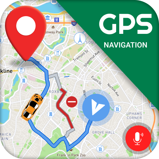
GPS Maps Voice Navigation App
GPS Maps Voice Navigation App free - Navigate easily and use reliable car driving directions with voice navigation for stress-free travel!
Looking for a talking map directions app to easily reach your destination? Do you need a GPS map voice navigation app to find the shortest and easiest route? You’re in the right place! Download GPS Maps Voice Navigation App free and find your destination by following the shortest path.
This voice GPS driving directions free app allows you to navigate towards your destination and guides you every turn. With traffic driving, cycling, and walking direction modes, our free GPS navigation and path finder app makes it easier and safer to find the way to your destination. So, download GPS Maps Voice Navigation App now and get free driving directions for hassle-free travel!
Key Features of GPS Voice Navigation Free:
✅ Turn-by-turn GPS navigation live map
✅ Driving directions maps with speaking navigation
✅ Precise and live location voice navigation with satellite map
✅ High-quality, up-to-date 3D maps for driving directions
✅ Live traffic information to avoid congestion and find faster routes
✅ Discover nearby restaurants, gas stations, ATMs, hotels, and more on your route
✅ Numerous GPS navigation free tools like speedometer, weather forecast, compass, days and currency calculator, and more
✅ Useful GPS navigation tools such as location marking, meet in middle, parking finder etc.
🔊 Turn-by-turn free voice navigation for driving
No more missed turns or distractions—just clear and concise free voice GPS driving directions, so you can focus on the road ahead. In this GPS Maps Voice Navigation App free turn-by-turn map route highlight guides you safely and clearly to your destination.
🔍 Explore new places
Discover nearby restaurants, gas stations, ATMs, and more! This GPS voice map navigation and directions app makes it easy to find places to stop or explore during your journey.
🚗 Live voice GPS driving route map
Get up-to-date, detailed maps and voice driving directions GPS that ensure you’re always on the right path. Whether you’re driving in the city, exploring the countryside, or heading on a long road trip, our GPS route finder and navigation app uses precise technology to provide accurate routing and directions.
📍 Share your location
With this GPS maps voice route finder, you can undoubtedly explore the course and share your area with others utilizing GPS navigation and map direction application so your family companions will know where you are.
🚦 Live traffic information
Avoid congestion and delays with real-time maps GPS navigation traffic alert updates. Finding faster routes has never been easier. This GPS navigation maps and traffic app continuously monitors traffic conditions and suggests alternative routes, saving you valuable time and frustration.
🧭 Navigation tools
In this GPS navigation with voice app, we offer numerous tools such as a digital compass and a qibla locator to ensure that you’ll never get lost, or a speedometer to help you stay compliant with traffic laws. This GPS with voice directions app also enables you to use the tools like weather forecast, days and currency calculator so that you can plan the important aspects of your trip in advance.
GPS navigation map route finder app - Try out free maps and driving directions app free to reach your destination as quickly as possible!
How does it work?
Download GPS Maps Voice Navigation App and open it.
Select your Precise Location or click the Auto Location Identify button.
Choose your Destination.
Follow the voice directions and on-screen prompts as you drive. The gprs road map live app will adjust the route dynamically based on real-time traffic data.